
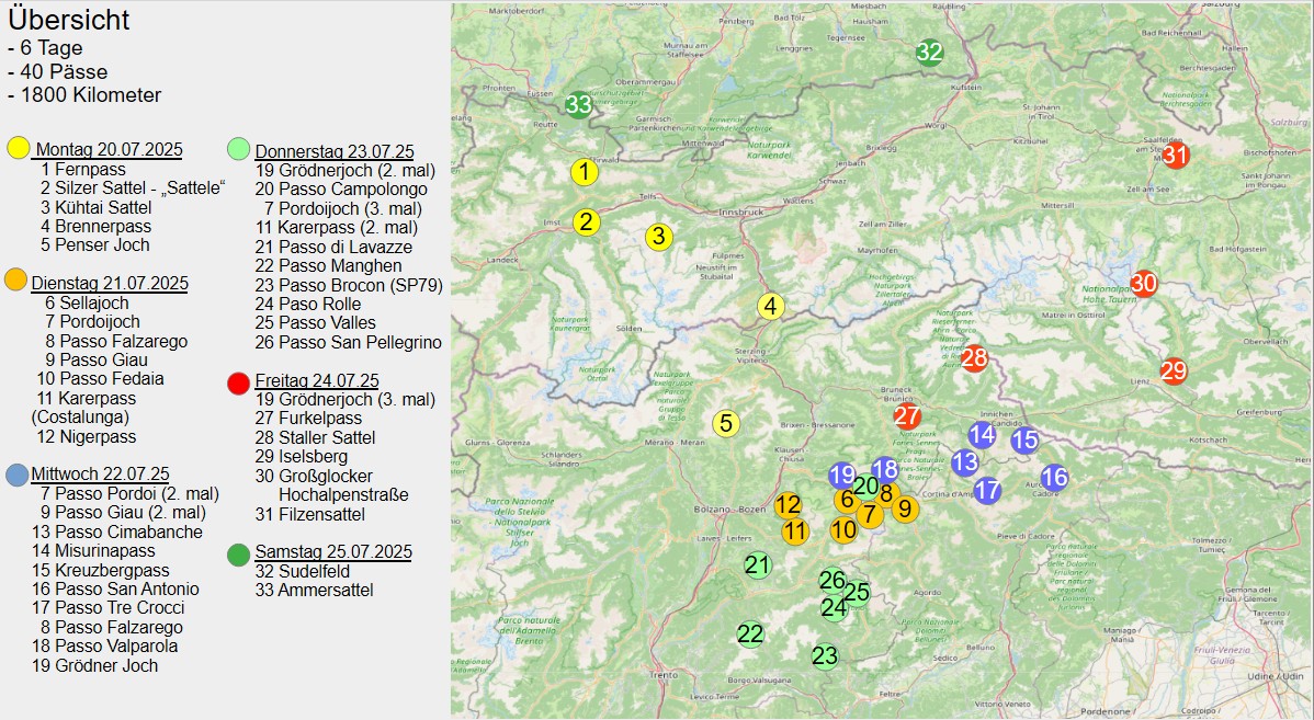
The Dolomites were the destination of the 2026 motorcycle tour. One reason for this was the announcement that the Gardena Pass, and therefore the legendary Sella Ronda, was due to be partially closed from September 2026 onwards. So, if there was still an opportunity to ride this classic among the Alpine passes one more time, it had to be taken.
There was also some unfinished business dating back to 2023. At the time, I had been forced to abandon my planned tour of the Dolomites prematurely. The float needle valve on my YB8 had jammed, putting the Dolomites on the list of tours still waiting to be completed.
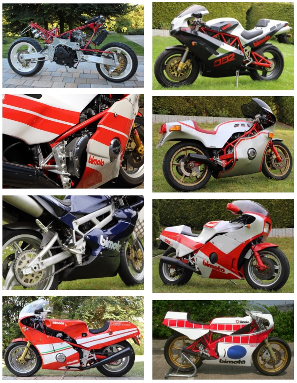
Once again, the trailer was the preferred choice for getting to the starting point. The plan was to begin the tour in Leuterschach in the Allgäu region. Alongside the Ducati Monster, there was also room for the Bimota YB10 on the trailer. The idea was not to ride the Bimota for the entire tour, but a short ride on the day of arrival, taking in the Fern Pass and the Hahntennjoch, would have been a great way to start the trip. After all, there are worse things than driving around 700 kilometres by car and then taking a Bimota over an Alpine pass.
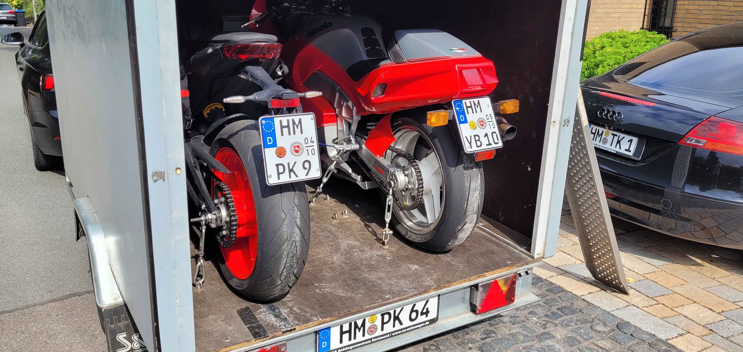
That was why I set off early. If everything went according to plan, the nearly 700 kilometres should be completed by early afternoon, leaving enough time for the first ride in the mountains. That was the plan, anyway. Reality turned out to be somewhat different. Already on the A7 motorway, several roadworks caused delays. At times, traffic was reduced to a single lane, slowing things down considerably. On top of that, the school holidays had just begun in North Rhine-Westphalia, resulting in heavy traffic on the motorways.
The ambitious schedule therefore increasingly turned into a test of patience. The kilometres seemed to drag on, and the Bimota ride that had originally been planned for the afternoon was slipping further and further away. In the end, the nearly 700-kilometre journey took almost eleven hours.
At that point, even the appeal of riding a Bimota over the Alpine passes was no longer enough to justify another three or four hours on the road. After such a long day of travelling, the planned ride over the Fern Pass and Hahntennjoch would probably have felt more like an obligation than a pleasure. So the Bimota remained on the trailer for the time being. But the plan was not completely abandoned. There would still be an opportunity for the short ride before the actual departure.
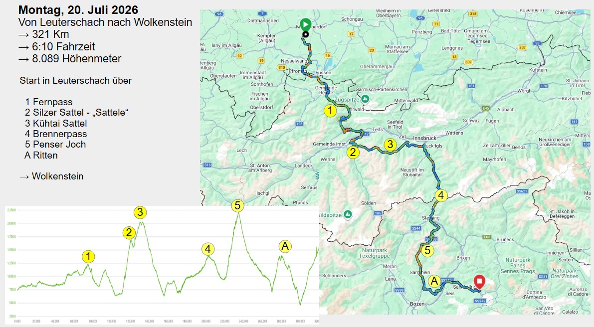
The next morning, the motorcycle tour could finally begin. From Leuterschach in the Allgäu, the first stage took us to Wolkenstein in Val Gardena. A hotel had been booked there for four nights, making it the perfect base for the many passes and panoramic roads that were waiting for us over the next few days. The 321 kilometres to Wolkenstein, however, were to be anything but a simple transfer ride.
The first pass of the day was the Fern Pass. Instead of continuing through the Inn Valley towards Innsbruck, as would normally be the case, we immediately chose an alternative route away from the classic road. Via the Silzer Sattel, known locally as the “Sattele”, the road climbed towards the Kühtai Saddle. At an altitude of 2,020 metres, this was already the first 2,000-metre pass of the tour.
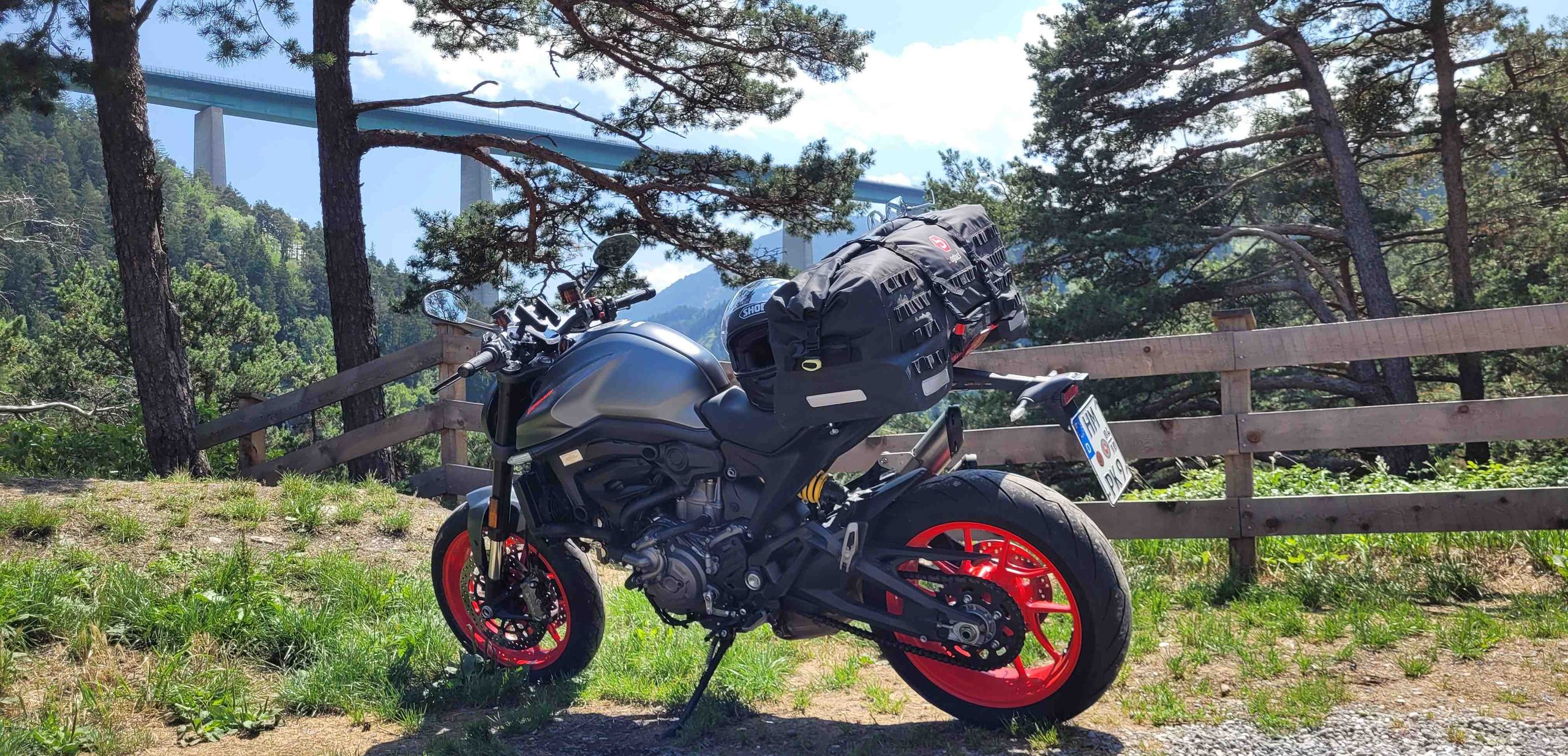
From Kühtai, we descended back into the Inn Valley and continued towards the Brenner Pass. Rather than taking the motorway, we chose the old Brenner Road. The views alone make this route worthwhile. One of the highlights is the spectacular view of the Europabrücke, which spans the Wipp Valley high above the landscape.
The road then continued upwards to the Brenner Pass before descending towards Sterzing. The next pass of the stage was already waiting there: the Penser Joch. The road up to the Penser Joch offered exactly what makes a great Alpine stage – bends, climbing metres and constantly changing views. After reaching the summit, we descended on the other side and continued towards the Ritten plateau.
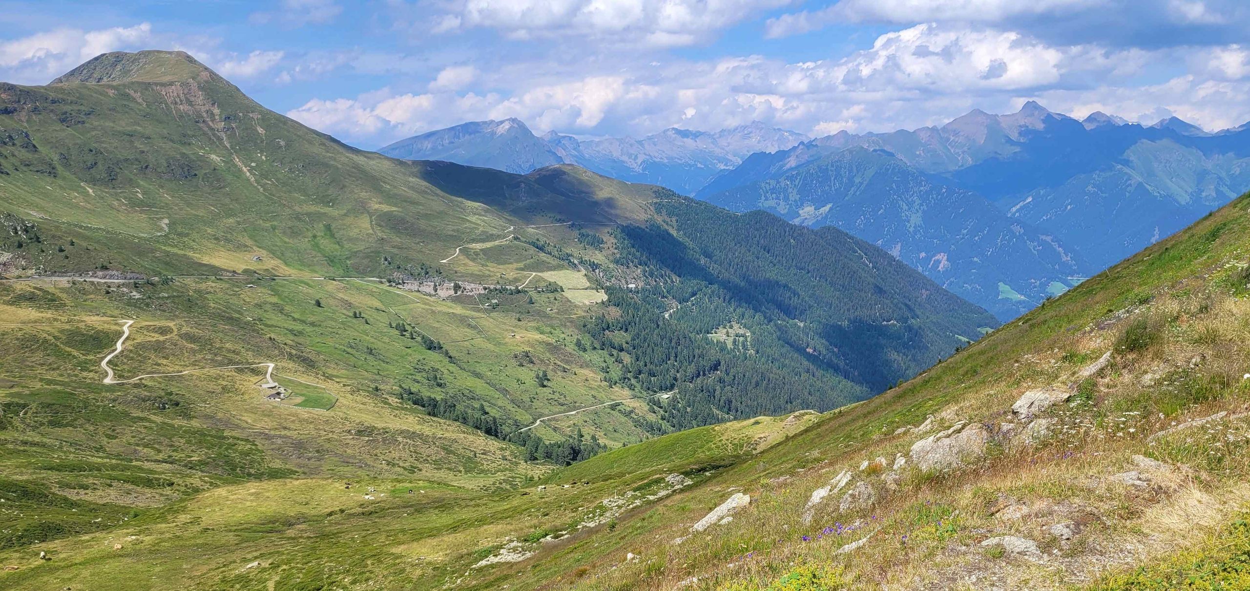
From the Ritten, the route gradually drew closer to the Dolomites. The scenery became increasingly impressive, and anticipation for the days ahead continued to grow.
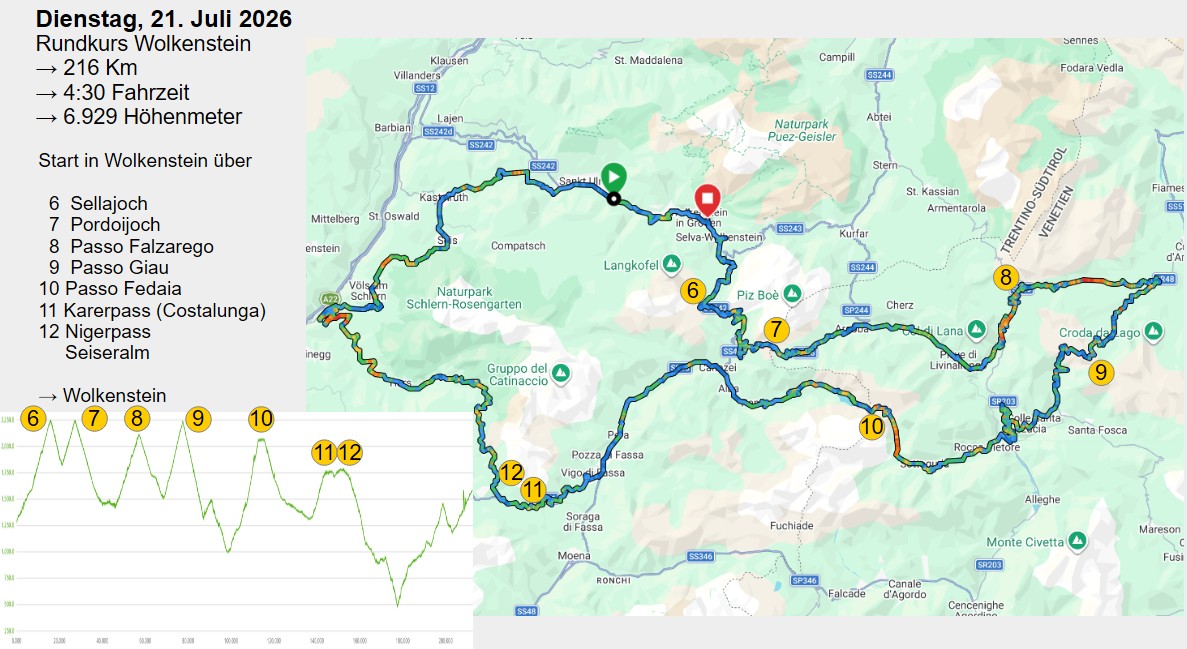
After this successful opening stage, the second day was devoted to our first proper Dolomites loop. Wolkenstein was both the starting and finishing point, with around 220 kilometres and a whole series of the Dolomites‘ most famous passes lying between them. The route therefore promised plenty of bends and elevation gain – and, above all, several mountain passes reaching well over 2,000 metres above sea level.
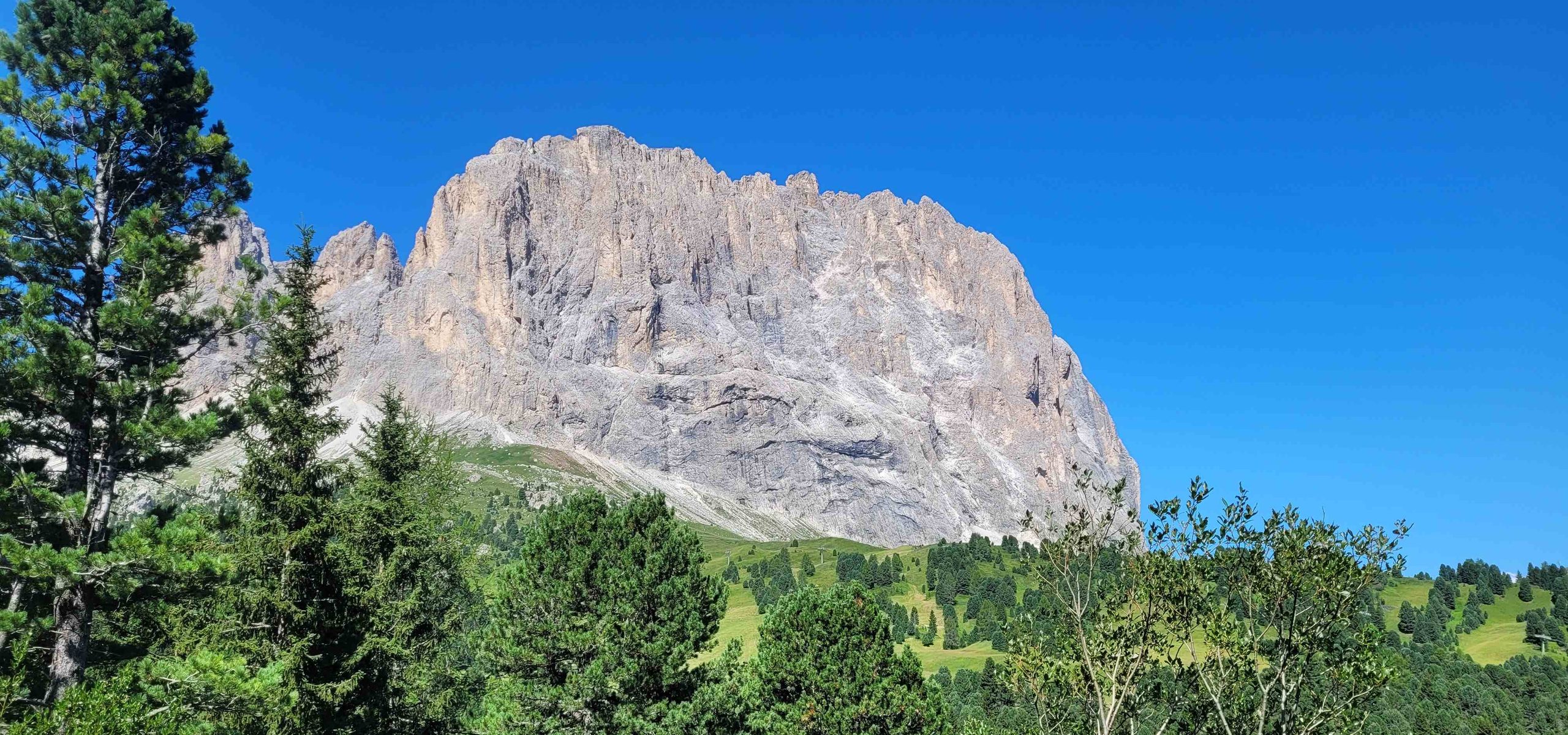
From Wolkenstein, we initially climbed towards the Sella Pass. At an altitude of 2,218 metres, it was the first 2,000-metre pass of the day. The Sella Pass lies between the Sella Group and the imposing Langkofel and connects Val Gardena with the Fassa Valley. The pass road winds its way upwards through numerous hairpin bends, offering spectacular views of the surrounding Dolomite peaks time and again.
Hardly had we reached the summit when the next classic was already waiting. Via Canazei, the route continued towards the Pordoi Pass. At 2,239 metres, it is slightly higher than the Sella Pass and therefore the second 2,000-metre pass of the day. The Pordoi Pass lies between the Sella and Marmolada massifs and impresses with magnificent views of the surrounding rock formations.
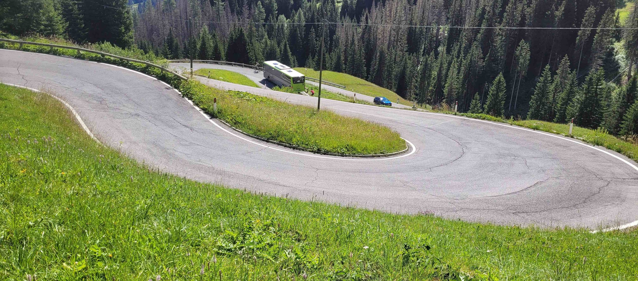
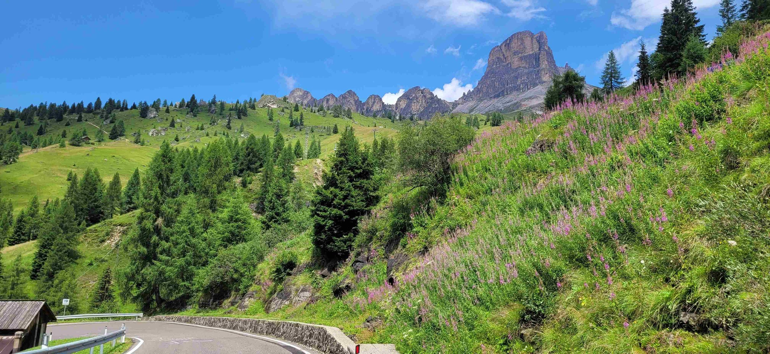
From the Pordoi Pass, we continued via Arabba towards the Falzarego Pass, at an altitude of 2,105 metres. From Falzarego, the route continued to the Giau Pass. At 2,236 metres, we had already reached the fourth 2,000-metre pass of the day. The Giau Pass is one of the most spectacular mountain passes in the Dolomites. The road is relatively narrow and extremely winding, but the reward at the top is a fantastic panoramic view of the distinctive Dolomite peaks.
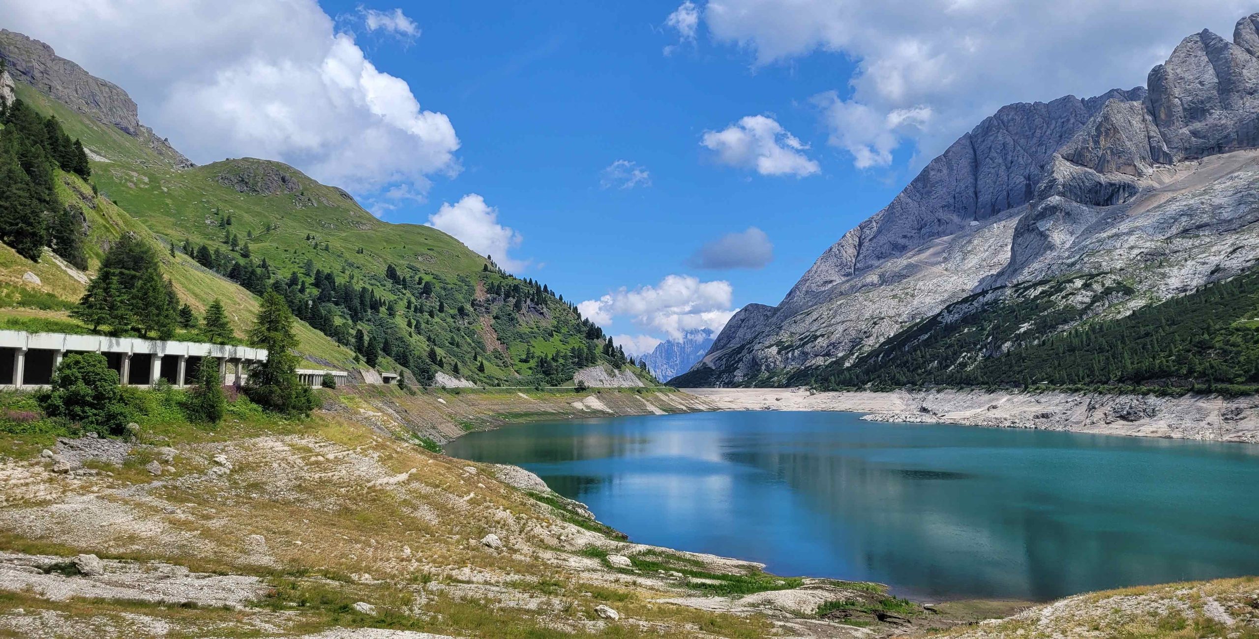
Another winding section of road then took us to the Fedaia Pass. At around 2,054 metres, this was yet another genuine 2,000-metre pass. The particular appeal of the Fedaia lies less in its altitude than in its location directly below the Marmolada. The Fedaia reservoir stretches along the foot of the massive mountain and creates a striking contrast between its turquoise waters and the pale rock faces of the Marmolada. At 3,343 metres, the Marmolada is the highest mountain in the Dolomites.
From Fedaia, we descended again before continuing over the Karer Pass, known in Italian as Passo Costalunga. At 1,745 metres, it remained well below the 2,000-metre mark, but in terms of scenery it certainly had nothing to hide. The Karer Pass lies at the foot of the Rosengarten and Latemar
mountain groups.
Nearby is the famous Lake Carezza, whose turquoise-blue waters and reflections of the surrounding peaks are among the classic photographic images of the Dolomites.
The next stop was the Niger Pass, another considerably lower crossing. The pass is situated at 1,690 metres between the Tiers Valley and the Eggental Valley and runs along the western foot of the Rosengarten group. The view of this spectacular mountain massif alone makes the ride worthwhile.
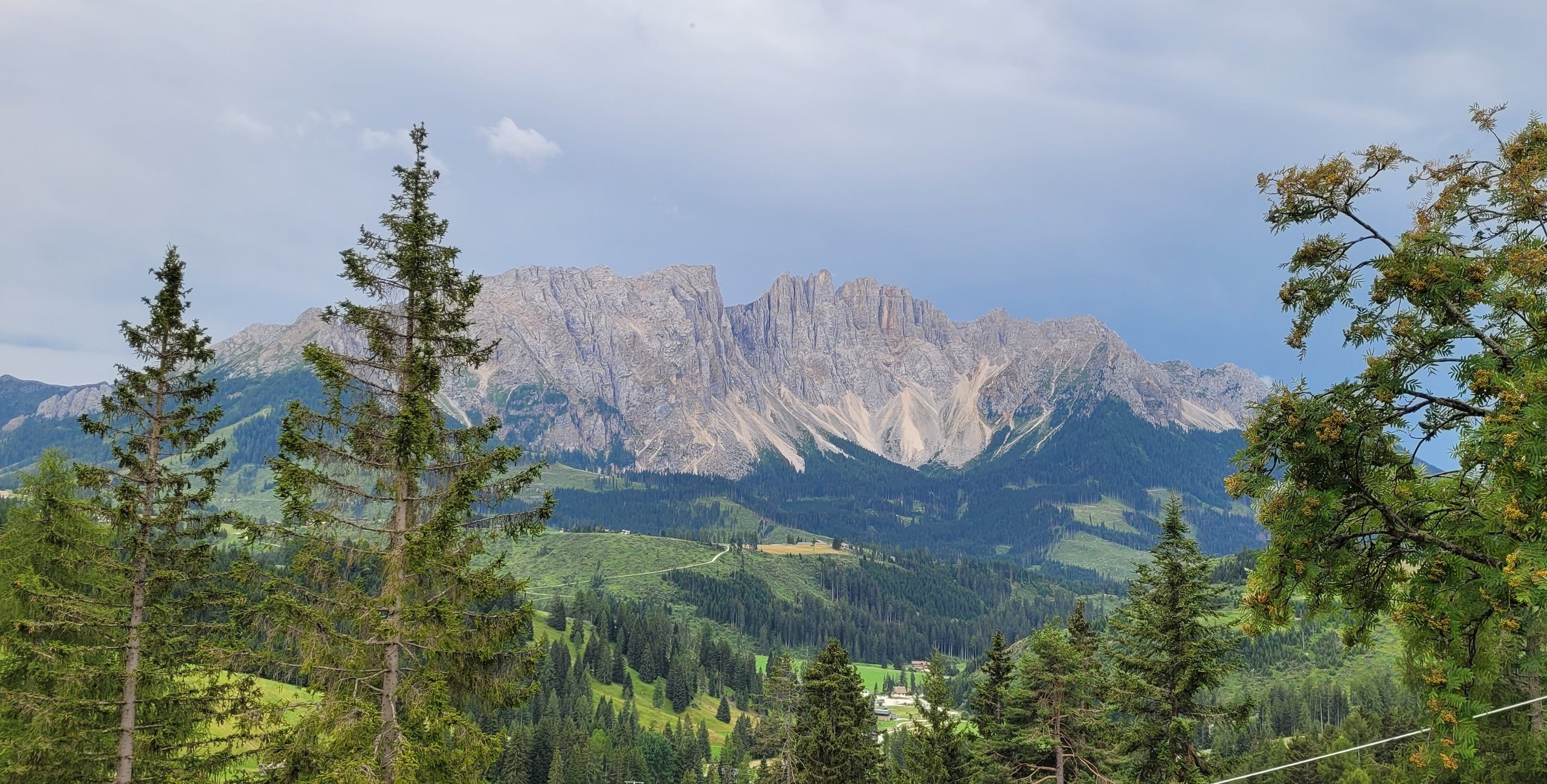
To round off the day, we crossed the Seiser Alm. The sheer scale of this high plateau is impressive. Covering around 56 square kilometres, it is the largest high-altitude Alpine pasture in Europe. It stretches across elevations ranging from approximately 1,680 to 2,350 metres, offering an extraordinary combination of vast alpine meadows and the rugged peaks of the Dolomites. From the Seiser Alm, the final section of the route took us back to Wolkenstein.
By the end of the day, 220 kilometres had been added to the trip meter. The route had included no fewer than five passes above 2,000 metres – the Sella Pass, Pordoi Pass, Falzarego Pass, Giau Pass and Fedaia Pass – as well as the Karer Pass, Niger Pass and the Seiser Alm.
It was already clear on the second day of the tour that choosing Wolkenstein as our base for four nights had been exactly the right decision. The Dolomites offer so many spectacular mountain roads and passes that even a 220-kilometre loop is barely enough to explore a small part of what this extraordinary region has to offer.
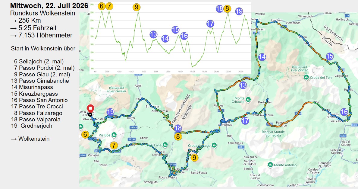
The third stage was an even longer loop. In the end, we covered 256 kilometres, once again starting and finishing in Wolkenstein. Part of the route was already very familiar by then: the Sella Pass, Pordoi Pass and Giau Pass. After that, however, we headed further east, into a part of the Dolomites that we had not yet explored on this tour. New passes, new landscapes and, above all, some of the most beautiful mountain lakes in the region were waiting for us.
From the Giau Pass, we continued towards Cortina d’Ampezzo and then followed the SS51 through the Höhlenstein Valley. The next pass was Passo Cimabanche. At 1,530 metres, it was not particularly high, but the surrounding scenery was nevertheless impressive. The road ran between imposing mountain ranges. To the north rose, among others, the Hohe Gaisl and the Dürrenstein, while to the south was the Cristallo Group, with peaks reaching more than 3,200 metres.
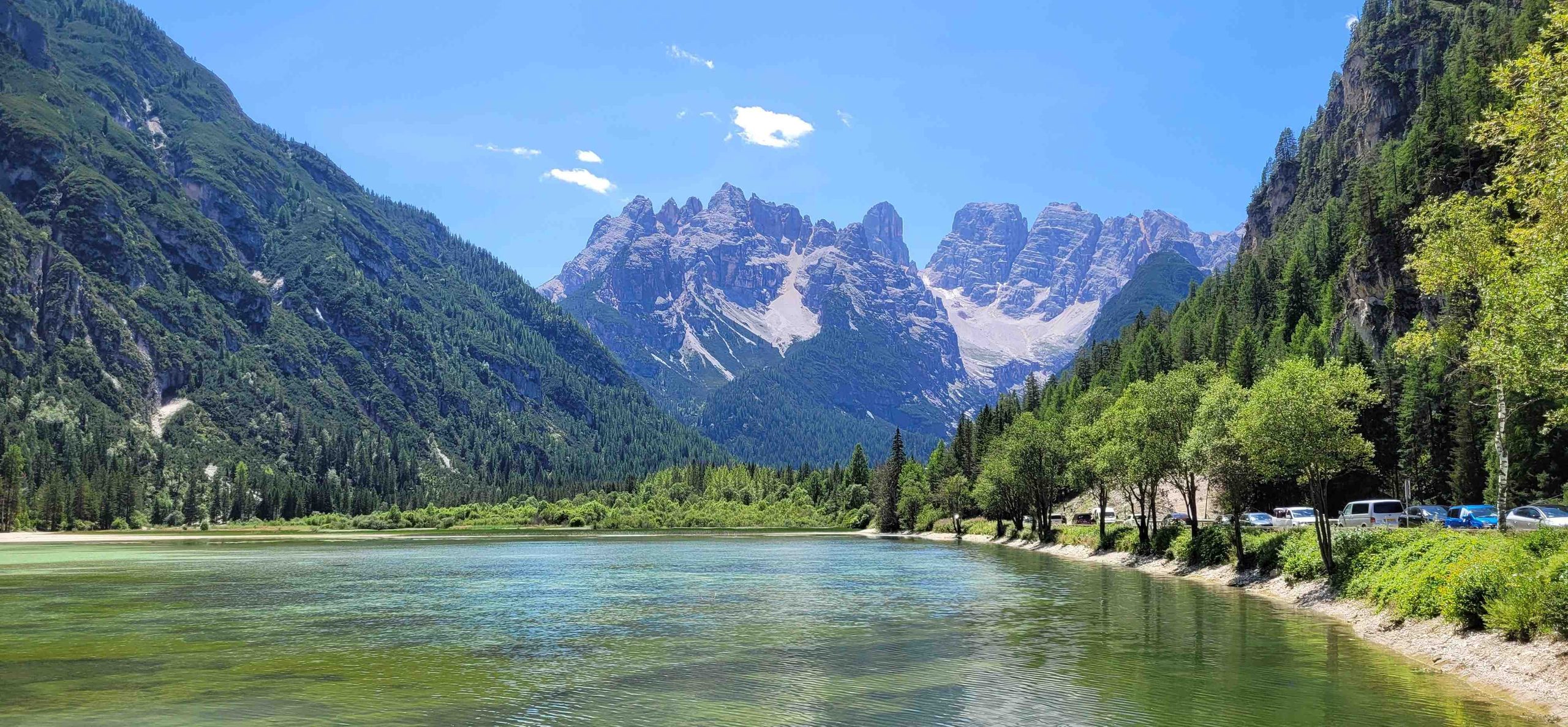
Shortly after the pass, the first lake of the stage was already waiting for us: Lake Landro (Lago di Landro). The lake lay directly alongside the road and, with good visibility, offered fantastic views of the surrounding mountains. The combination of the lake and the rugged Dolomite peaks made this one of the most scenic sections of the entire route.
For the next few kilometres, we travelled clockwise around the Three Peaks Nature Park, heading towards the Kreuzberg Pass and then over Passo San Antonio. Both crossings were considerably less famous than the Sella, Pordoi or Giau passes – and that was precisely what made this part of the tour so appealing. Away from the major Dolomite classics, there was noticeably less tourist traffic and a much greater sense of tranquillity.
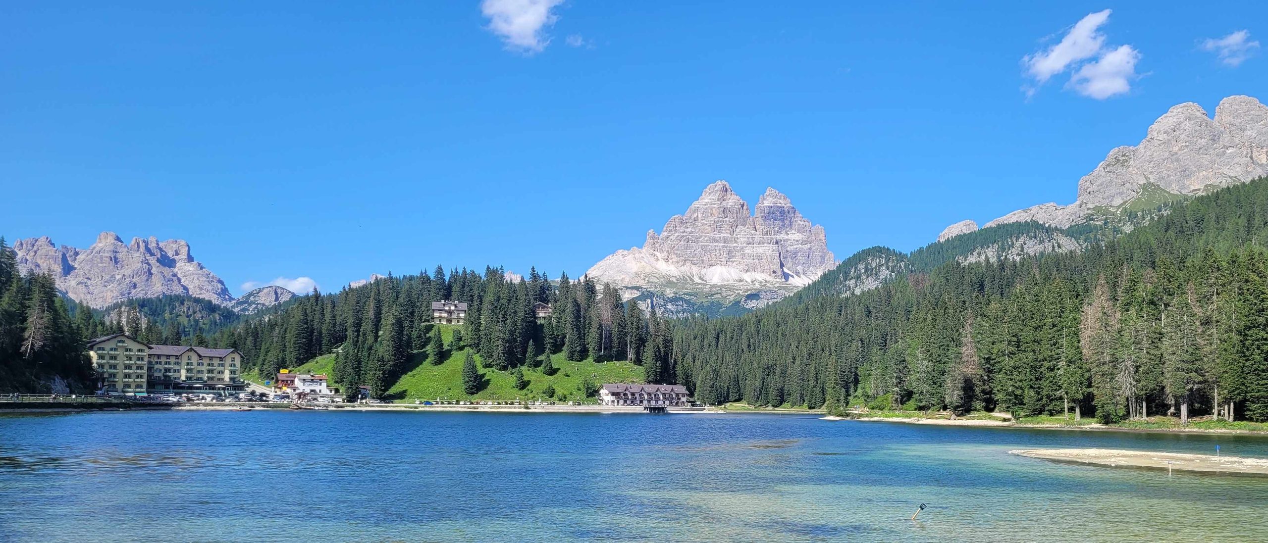
On the way back towards Cortina, we stopped at two more lakes. First came the beautifully turquoise Lago di Santa Caterina, which lay directly alongside the road. We then made a worthwhile detour to Lake Misurina, situated at an altitude of around 1,750 metres.The lake was surrounded by the distinctive peaks of the Cadini Group, Cristallo and Sorapiss and, when visibility was good, the famous Three Peaks could also be seen in the distance. Its spectacular location made Lago di Misurina one of the best-known and most photographed lakes in the Dolomites.
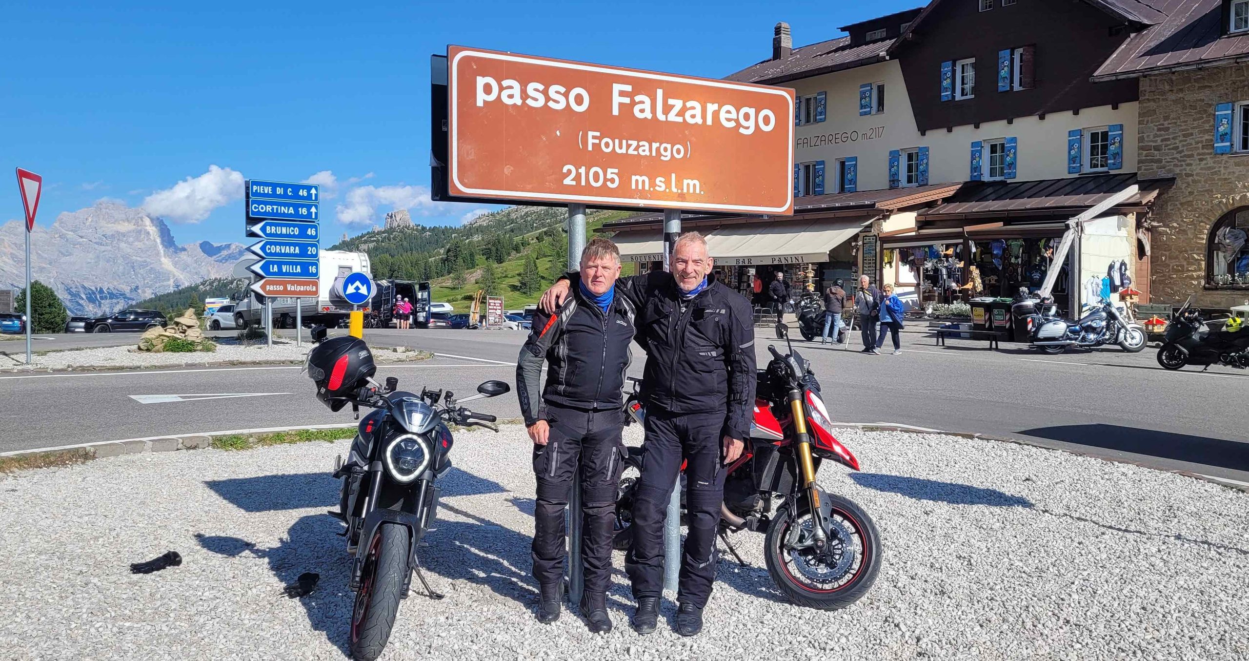
After our short stop at the lake, we continued to Passo Tre Croci and then on to the Falzarego Pass. At 2,105 metres, Falzarego once again took us above the 2,000-metre mark. This was already the fourth high pass of the day. After the heights we had already reached at the Sella, Pordoi and Giau passes, this stage had certainly accumulated its fair share of elevation gain as well.
From Falzarego, we continued directly to the Valparola Pass, at 2,192 metres. This pass was another one of the great classics of the Dolomites. The road passed Lake Valparola and wound through an impressive landscape of towering rock formations. The summit lay between the Fanes Group and the Sella Group and offered excellent views of the surrounding peaks.
Even the final kilometres back to Wolkenstein took us high into the mountains once more, crossing the Gardena Pass at 2,121 metres. The pass connected Val Gardena with the Val Badia and lay between the Sella massif and the Cir Peaks. The Gardena Pass had a particular significance on this tour. After all, the announced partial closure of the pass from September 2026 onwards had been one of the reasons we had decided to plan our Dolomites tour for this particular year.
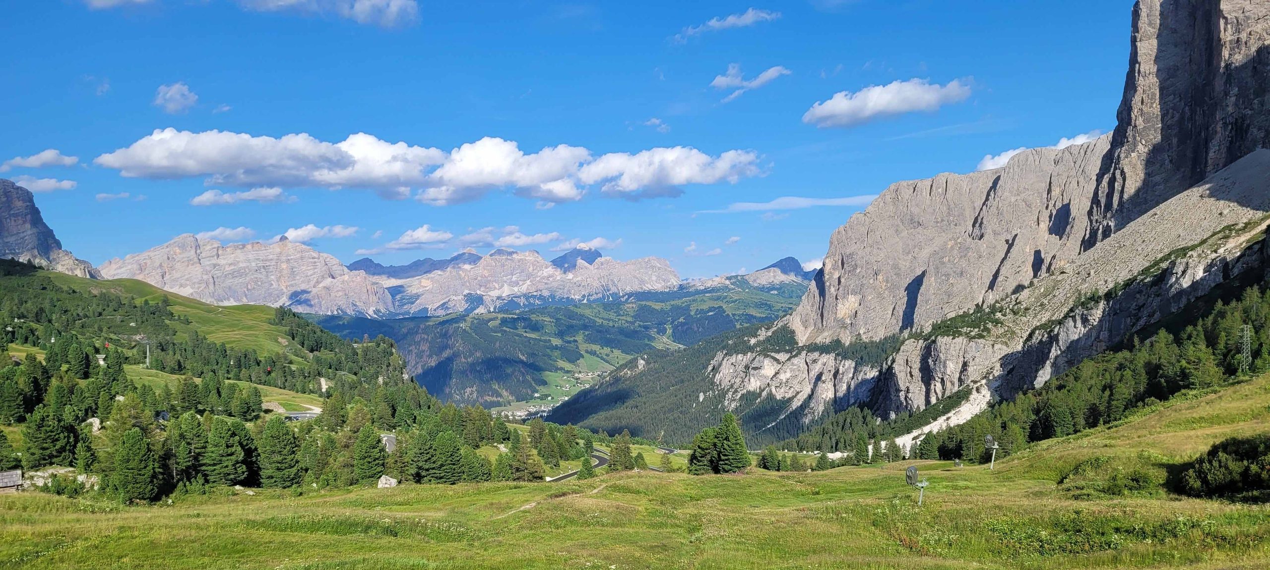
Back in Wolkenstein, 256 kilometres were behind us – another fantastic day in the Dolomites, with high mountain passes, spectacular lakes and plenty of roads that had made every kilometre worthwhile.
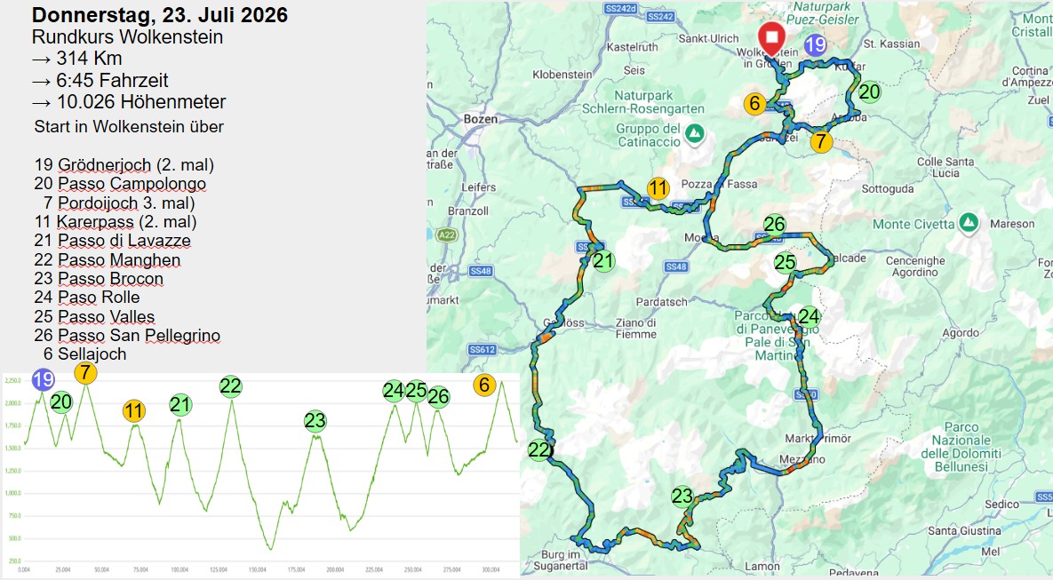
For the fourth stage, we set out on our third major loop through the Dolomites, once again starting and finishing in Wolkenstein. This time, the route took us considerably further south into the Dolomites. A total of 314 kilometres lay ahead of us, along with a whole series of legendary Alpine passes.
We began by heading east over the Gardena Pass, descending towards Corvara and continuing on to the Campolongo Pass. At 1,875 metres, the Campolongo remained just below the 2,000-metre mark, but it was nevertheless one of the four classic passes around the Sella massif. Together with the Gardena, Pordoi and Sella passes, it forms the famous Sella Ronda. Campolongo is the lowest of the four passes.
The next well-known pass followed almost immediately: the Pordoi Pass, which we crossed for the third time on this tour. After descending from Pordoi, we continued towards the Karer Pass. From there, we had travelled far enough south to encounter some new passes.
The first was Passo di Lavazè, at 1,805 metres. The road led us across open mountain meadows and offered beautiful views of the surrounding slopes as well as the small lake in the area. We then continued further south towards Passo Manghen. At 2,047 metres, Manghen is a relatively remote and unspoilt pass. Compared with the famous Dolomite passes, it felt noticeably quieter. And that was precisely what made it so appealing: less tourist traffic, a demanding mountain road and plenty of untouched natural scenery.

From Manghen, we continued to Passo Brocon, which at around 1,615 metres lay considerably lower. The pass connects the Vanoi Valley with the Tesino plateau. Afterwards, a particularly beautiful sequence of passes began in the area of the Pale di San Martino.
First came Passo Rolle. At 1,984 metres, it just missed the magical 2,000-metre mark. The views, however, more than made up for those missing 16 metres. From the pass, we enjoyed a magnificent panorama of the distinctive peaks of the Pale di San Martino. Only a short distance later, we reached Passo Valles – and once again we were above 2,000 metres. The summit is at 2,031 metres.
The pass was particularly attractive because of its location between the mountain groups of the Pale di San Martino and the Marmolada region. The road took us through a landscape that felt considerably more remote and unspoilt than the busy classics around the Sella Group. After Valles came Passo San Pellegrino, at around 1,918 metres.
Rolle, Valles and San Pellegrino are remarkably close to one another. In little more than around 30 kilometres, three major Alpine passes followed one another in rapid succession – a veritable succession of mountain crossings packed into a very short stretch of road. After this impressive series of passes, we turned north again. Before returning to Wolkenstein, one final highlight awaited us: the Sella Pass again.
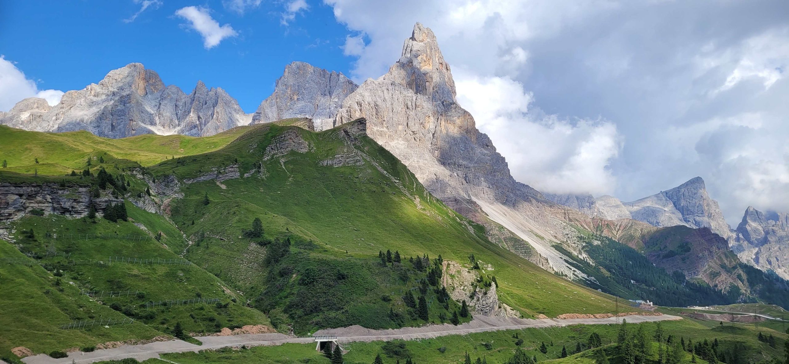
Back in Wolkenstein, 314 kilometres lay behind us, together with an impressive collection of passes through the southern part of the Dolomites. Everything that makes this mountain range so special was part of the route: immense rock formations, tight hairpin bends, quiet mountain roads, legendary classics and, again and again, the contrast between high Alpine landscapes and deeply carved valleys.
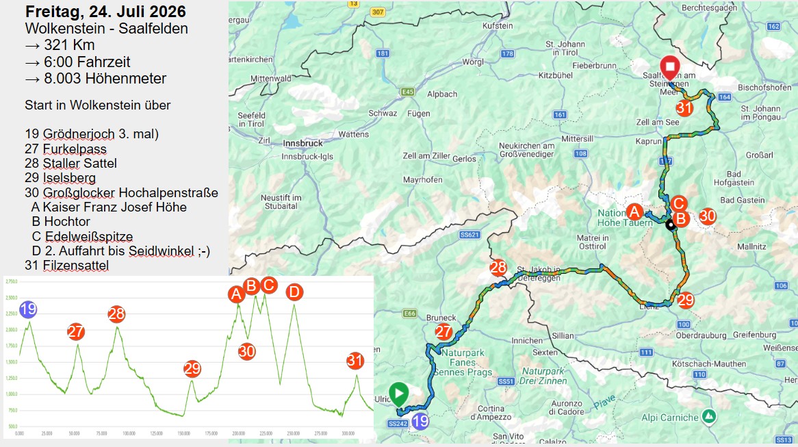
On the fifth day of the tour, we left Wolkenstein and the Dolomites behind and headed towards East Tyrol. One last time, we crossed the Gardena Pass, before continuing to the Furkel Pass. At 1,789 metres, it was considerably lower, but by no means boring. The pass connects the Val Badia with the Puster Valley and lies between Kronplatz and Piz de Peres. The climb was surprisingly steep in places and led through a varied landscape of forests and alpine meadows.
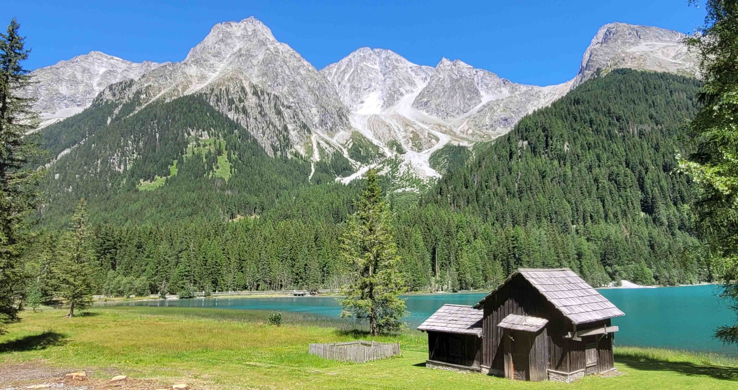
Our first longer stop was at the Antholz Biathlon Stadium, one of Europe’s most important biathlon venues. From there, we continued to Lake Antholz. Situated at around 1,640 metres, the mountain lake is surrounded by the impressive peaks of the Rieserferner Group and is one of the scenic highlights of the Antholz Valley. From the lake, the road began to climb towards the next major pass of the day.
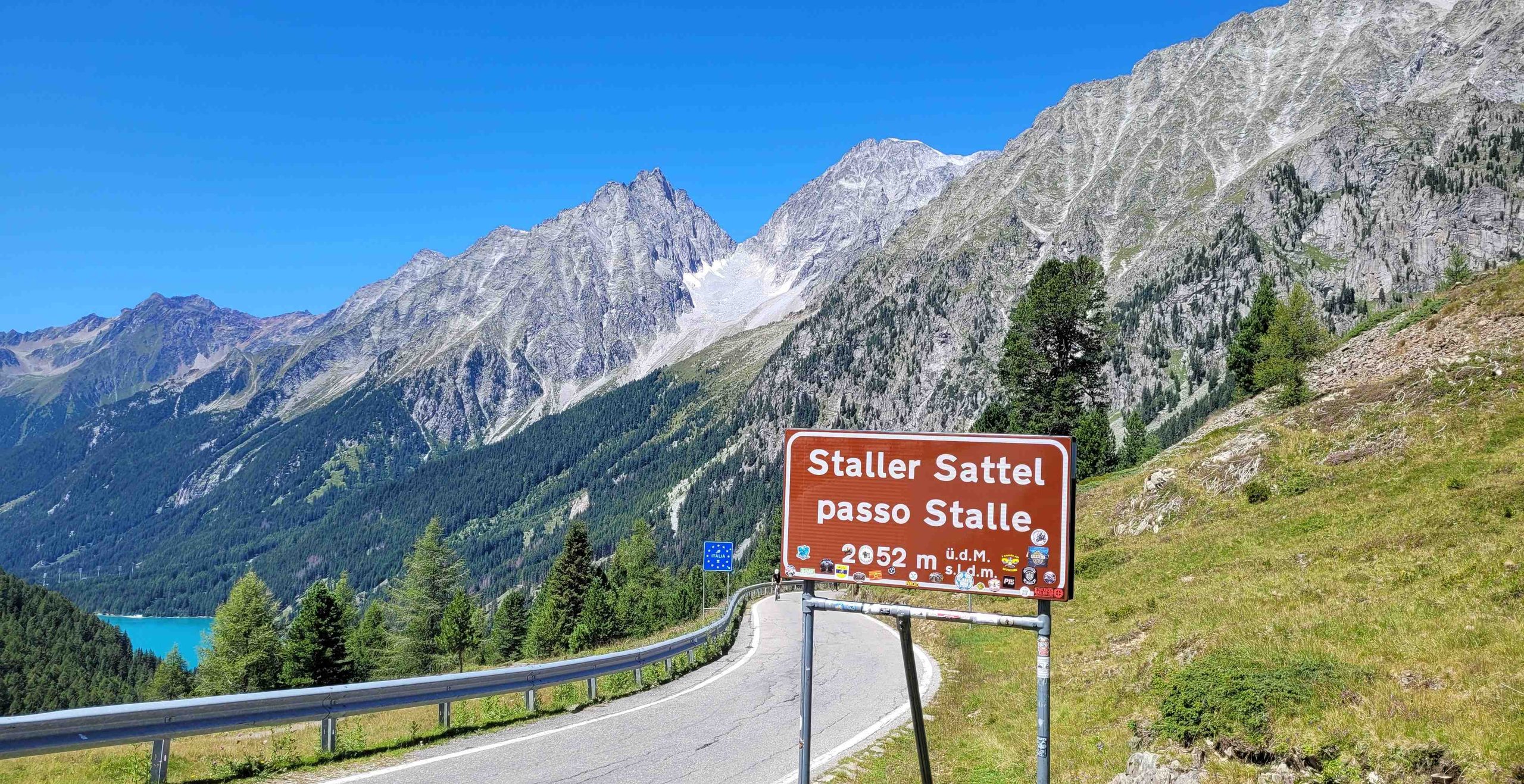
At 2,052 metres, the Staller Sattel was the second pass of the day to exceed the 2,000-metre mark. It connects South Tyrol with East Tyrol and lies directly on the border between Italy and Austria. The road on the Italian side was particularly interesting. In its upper section, it was so narrow that traffic could only pass in one direction at a time. A traffic light therefore regulated the flow: during specific quarter-hour periods, traffic was allowed to travel in one direction, followed by the opposite direction during the next period. Anyone arriving at the “wrong” time therefore gained an involuntary little break. At the summit, another small mountain lake awaited us: Obersee. From there, we descended towards Lienz.
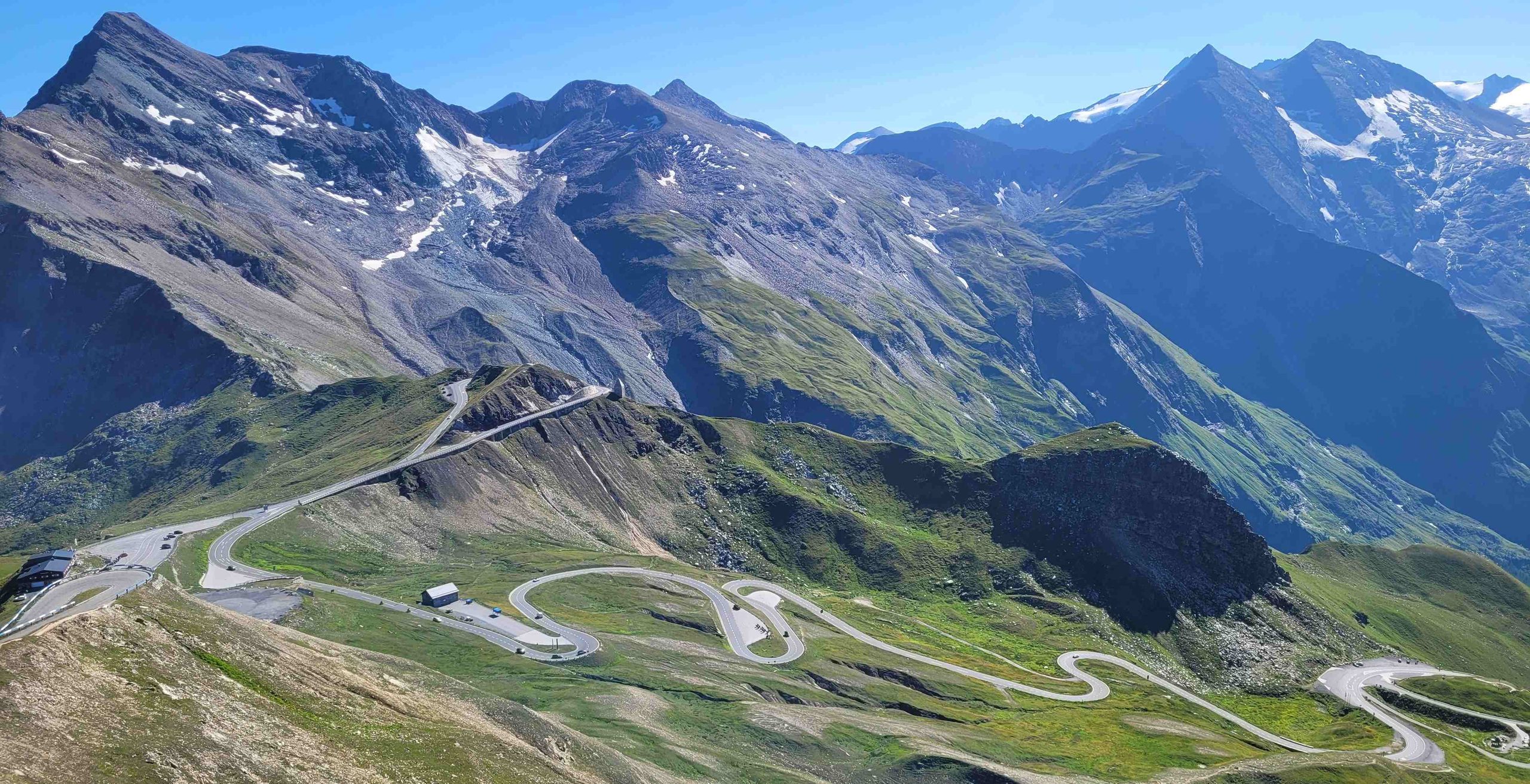
Via the Iselsberg Pass, we continued towards the highlight of the day: the Großglockner High Alpine Road. At the toll station, the first surprise was the price: €36.50 for a one-day motorcycle ticket. But the 48-kilometre panoramic road, with its 36 hairpin bends, and the journey right into the heart of the Hohe Tauern National Park made it well worth the money. The highest point accessible by road was the Edelweißspitze, at 2,571 metres, while the Hochtor reached an impressive 2,504 metres.
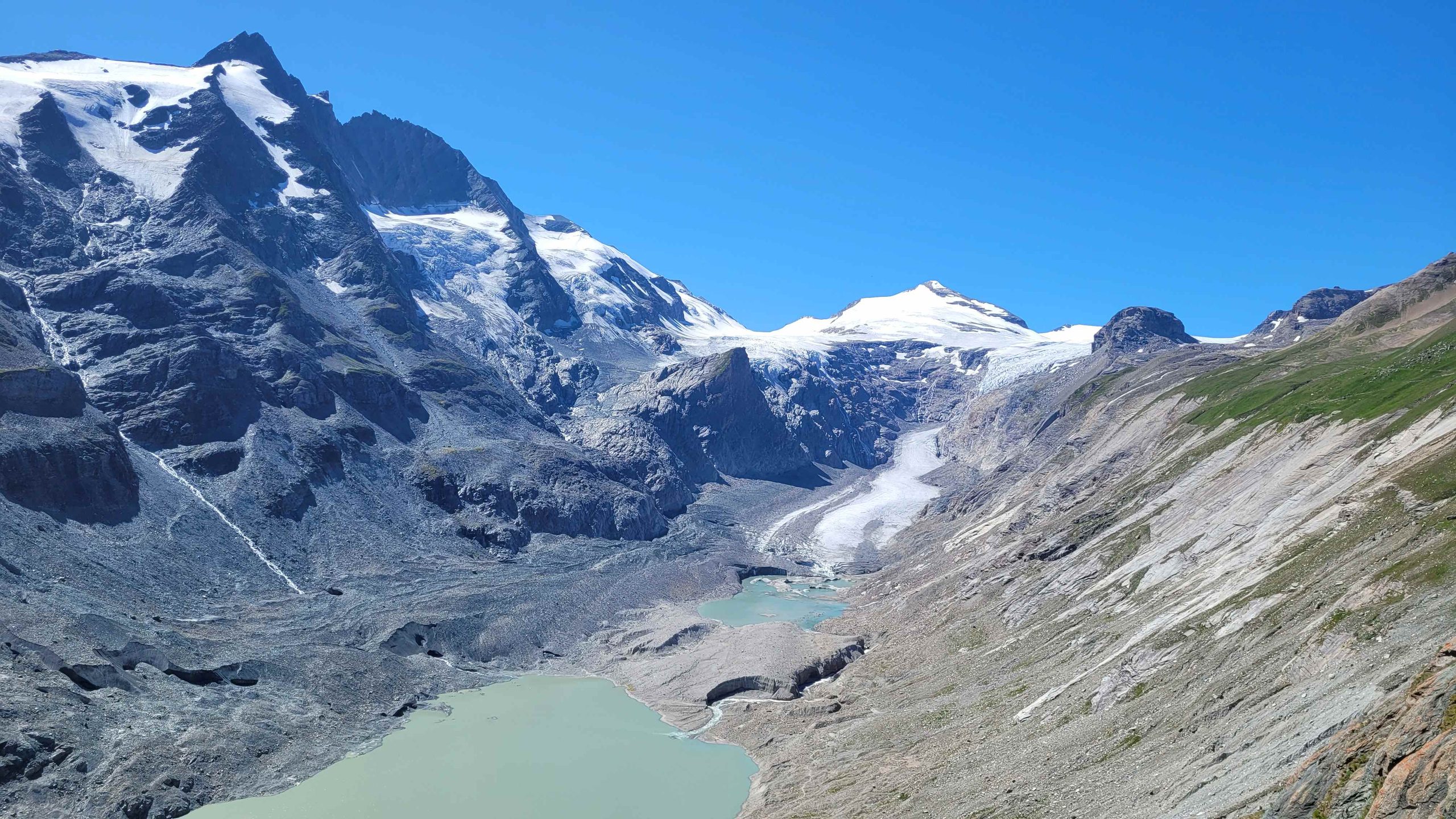
Our first stop was the Kaiser-Franz-Josefs-Höhe, at 2,369 metres. Suddenly, it was no longer just the mountain road itself that was the focus – the high Alps took centre stage. Opposite us rose the Großglockner, at 3,798 metres, Austria’s highest mountain. Below the viewing platform lay the Pasterze, the longest glacier in the Eastern Alps – or rather, what remained of it.
We continued towards the Hochtor, at 2,504 metres the highest point of the main pass road. The road passed through the Hochtor Tunnel and connected Salzburg with Carinthia. After all the passes we had experienced in the Dolomites, the Hochtor was nevertheless something special. The landscape felt different from the Italian Dolomites – less dominated by vertical rock walls and more expansive, open and distinctly high Alpine in character.
But the real highlight of the Großglockner ride was still to come. The turn-off to the Edelweißspitze led up a narrow road, partly surfaced with cobblestones. And suddenly the altimeter showed 2,571 metres. The Edelweißspitze was the highest point accessible by road on the entire Großglockner High Alpine Road. In good visibility, the view from the top stretched across countless peaks of the Hohe Tauern.
After taking in all these impressions, we left the Großglockner High Alpine Road and continued towards Saalfelden. But just before reaching the toll station on the northern side, we changed our minds. There was still a little more cornering fun to be had. So we turned around and rode back up once more, this time as far as Seidlwinkl, at the junction for the Edelweißspitze. The final pass of the stage was the Filzensattel, part of the Hochkönig Road. It provided beautiful views of the mountain scenery around the Hochkönig and brought another memorable day of riding to an end.
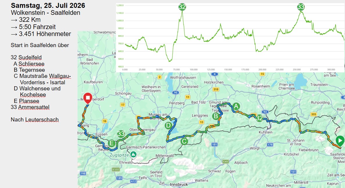
For the final stage of our Alpine tour, another 322 kilometres of varied riding lay ahead of us. The route took us from Saalfelden through the Bavarian Pre-Alps and the Isar Valley, past several beautiful mountain lakes and finally back to Leuterschach.
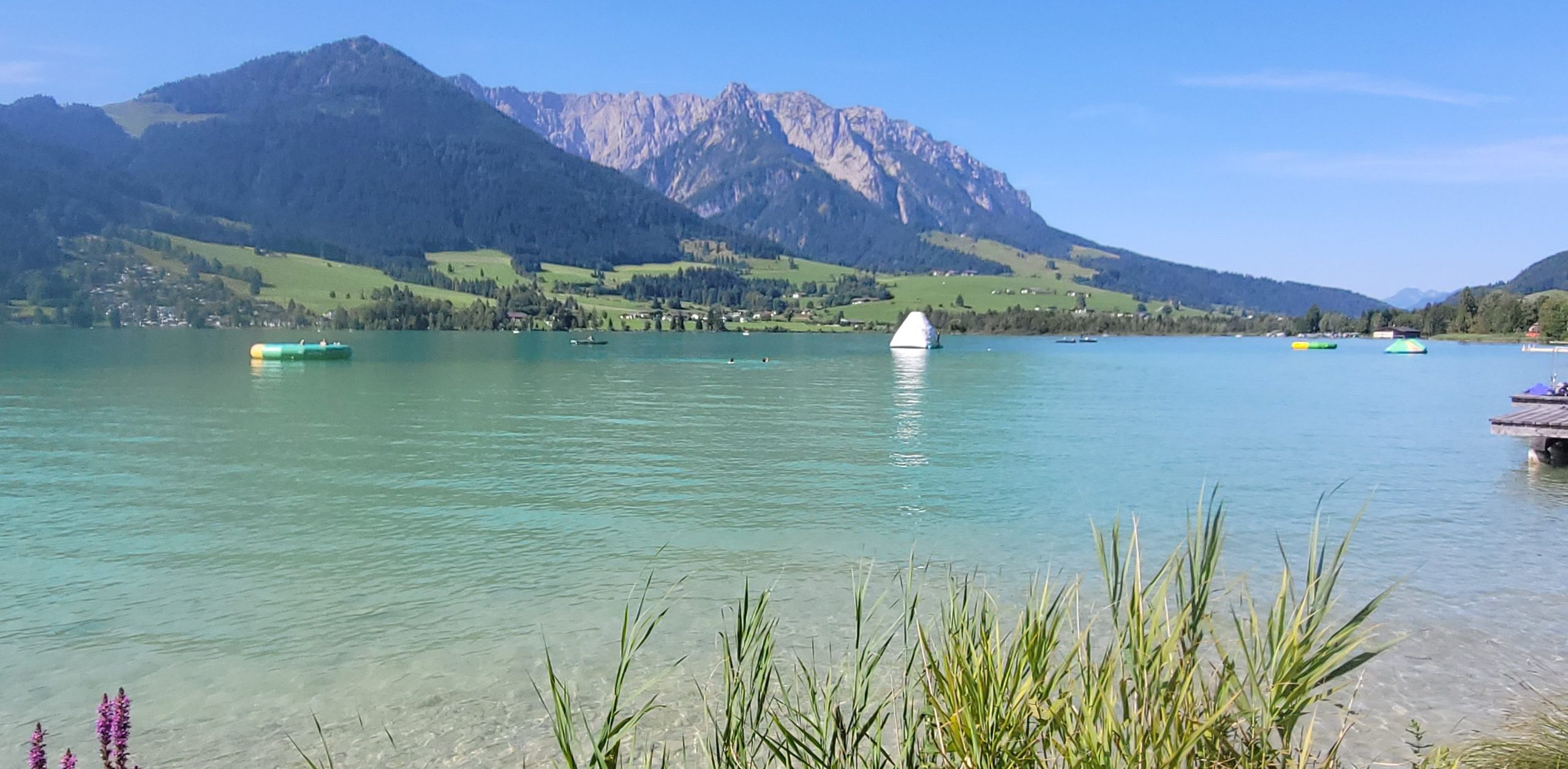
The first stop of the day was Lake Walchsee, whose spectacular panoramic setting invited us to take a short break. From there, we continued over the Sudelfeld Pass, which leads from the Inn Valley through the Mangfall Mountains to Bayrischzell. The route then took us along Lake Schliersee before continuing to Lake Tegernsee.
From Tegernsee, we headed towards Wallgau. One of the most special sections of the day’s route was the ride along the toll road from Wallgau to Vorderriss. The road led us right into the largely unspoilt Isar Valley. Here, the Isar could still be experienced in a remarkably natural setting, far away from the more heavily developed areas of the Alpine foothills. From the end of the toll road, it was only a few kilometres to Lake Walchensee. The deep-blue waters of the lake and the surrounding mountains made it another particularly scenic section of the route.
The connection between Walchensee and Lake Kochelsee was dominated by the Kesselberg, a winding mountain road linking the two lakes. After this varied section, we continued towards the Ammergau Alps and crossed the Ammersattel on our way to Plansee in Tyrol.
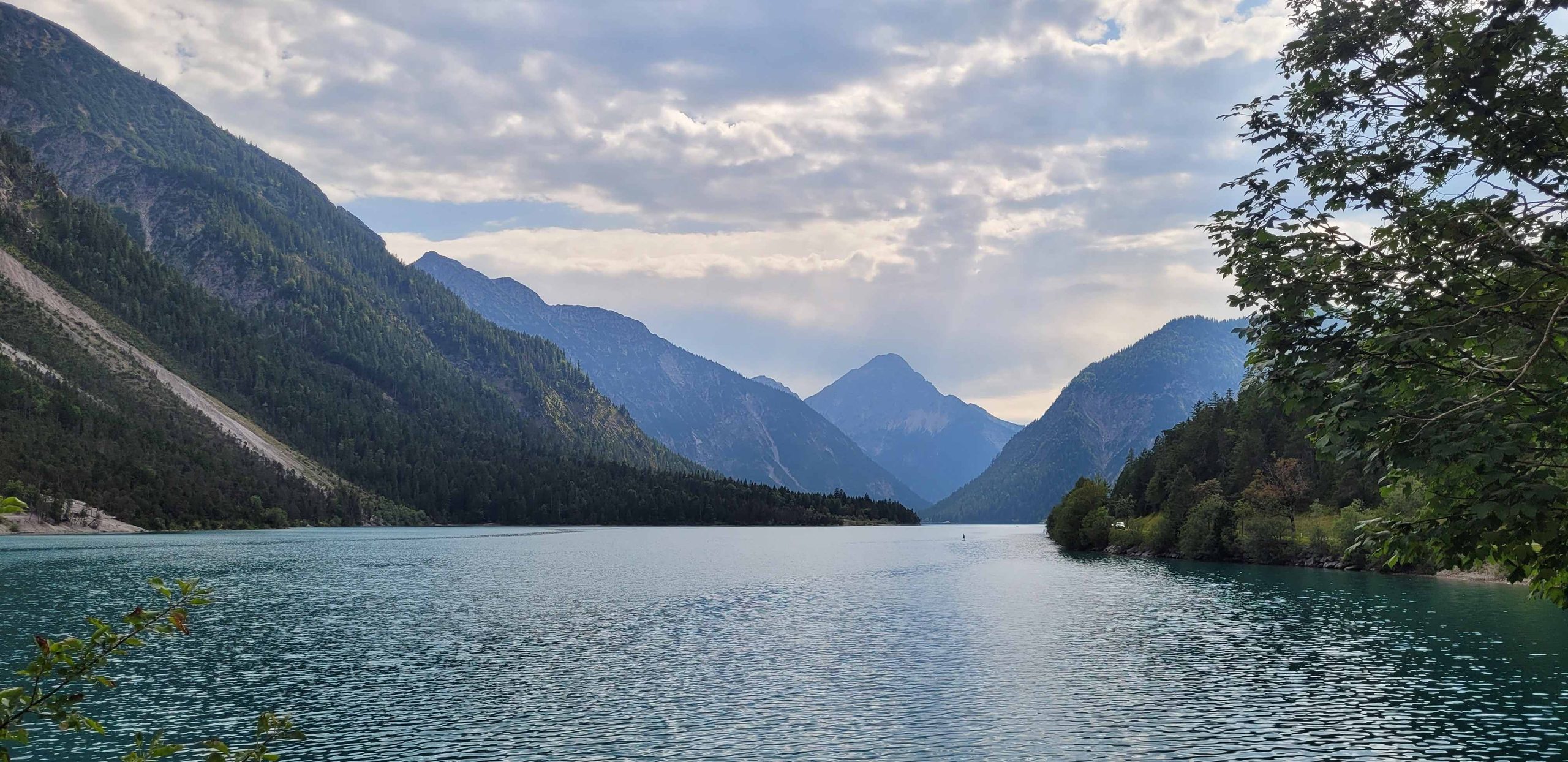
The lake impressed us with its exceptionally clear, turquoise-to-deep-blue water and the steep mountains rising around it. After the numerous high passes of the previous days, Plansee provided a particularly beautiful final Alpine backdrop.
Eventually, the last kilometres brought us back to Leuterschach. When we arrived, 322 kilometres had been added to the trip meter. Our Alpine tour ended with a varied final stage packed with bends, mountain roads and beautiful Alpine lakes set against an impressive mountain backdrop.
Over six stages and 1,800 kilometres, we had crossed more than 40 Alpine passes, including 14 passes above 2,000 metres. Searching online for the total number of rideable Alpine passes produces very different figures. If smaller crossings, minor passes and seasonally accessible mountain roads are included, the total is well above 500. For motorcycle touring, commonly used pass directories often list around 300 to 350 particularly interesting Alpine passes.
There are approximately 60 rideable Alpine passes with a summit above 2,000 metres. After this tour, I had ridden 51 of them. A fitting number to bring this Alpine adventure to a close.