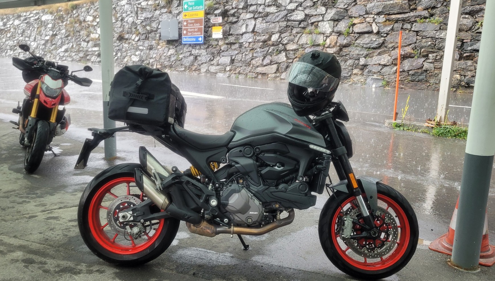
The 2025 Alpine Tour features some of the most spectacular and beautiful mountain passes in eastern Switzerland, as well as several lakes and passes in northern Italy. This time, our group consists of three Ducati riders. We start in Feldkirch, Austria, heading west. After only a few kilometers, we cross the Rhine and continue through Switzerland. Via Appenzell, Wattwil, and Siebnen, the route leads to the Sattelegg Pass (2) and on to the Ibergeregg Pass (3), which is well worth riding thanks to its well-developed hairpin bends and beautiful views of the surrounding alpine meadows.
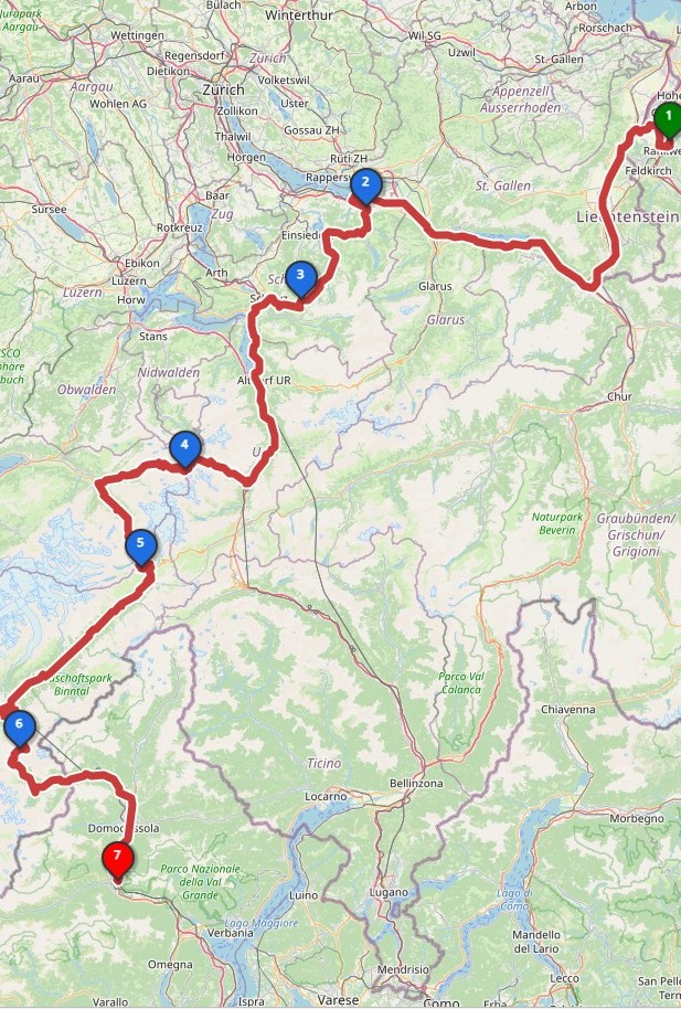
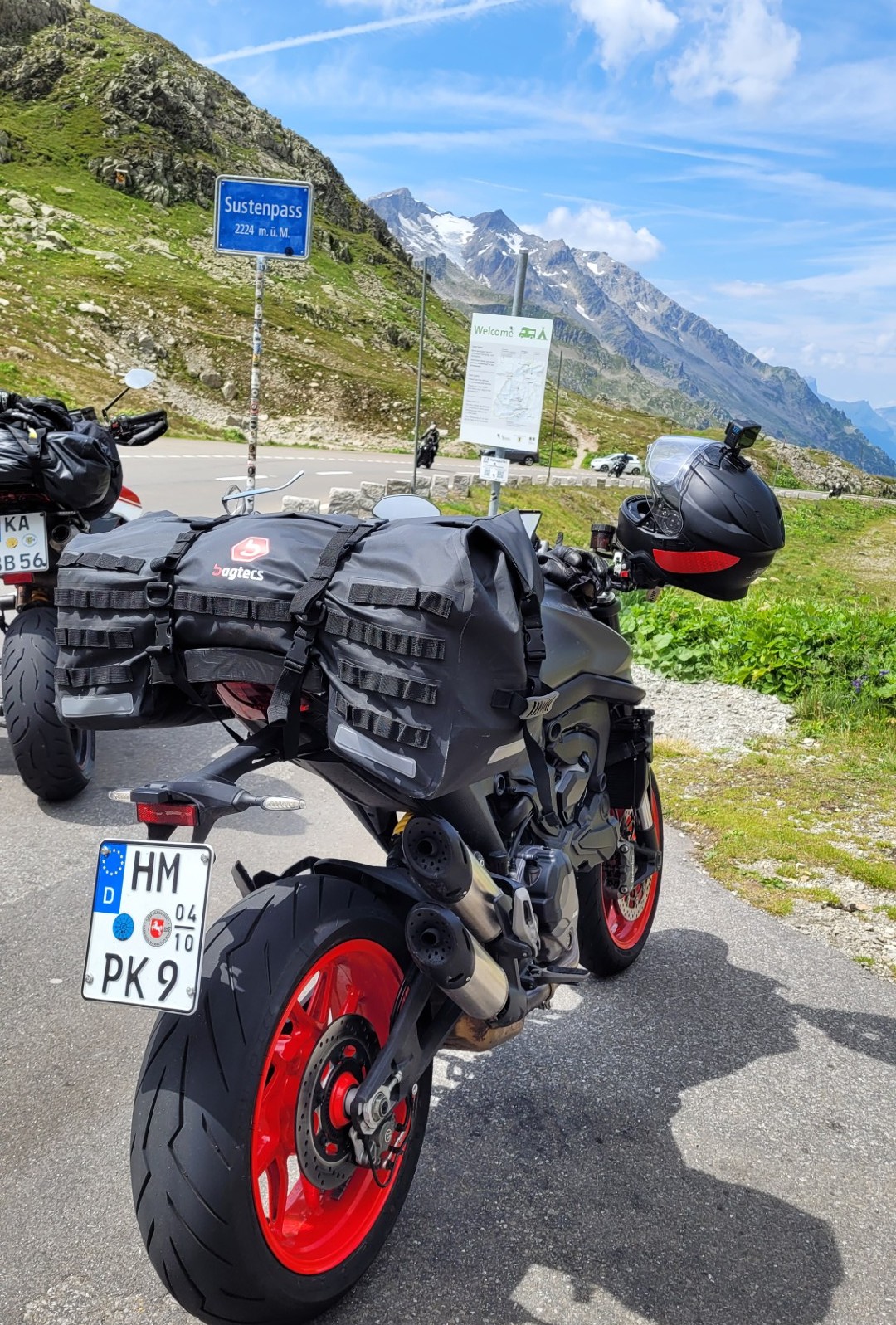
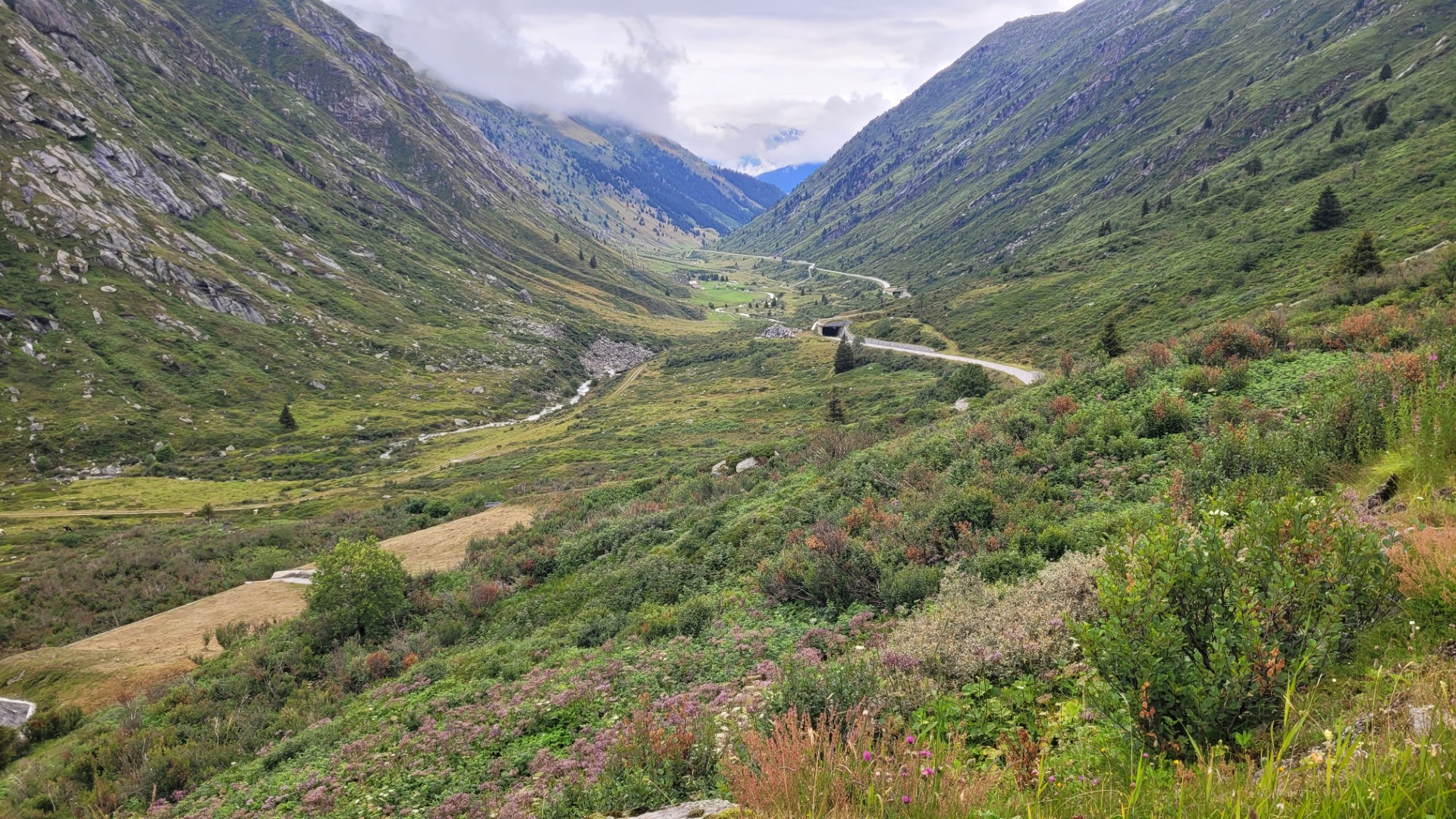
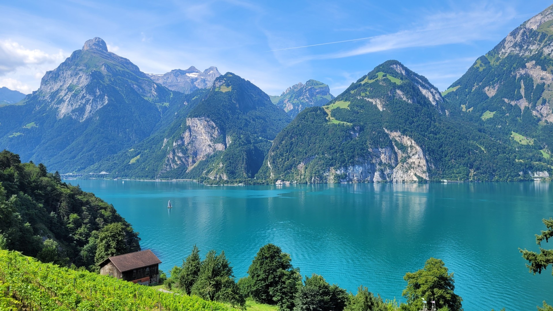
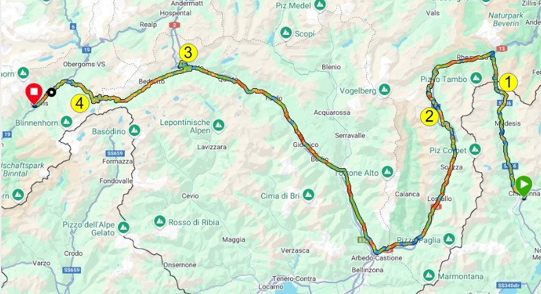
After around 150 kilometers, there are plenty of opportunities for a break along the eastern shore of Lake Lucerne before the route climbs through spectacular mountain scenery to the 2,264-meter-high Susten Pass (4).
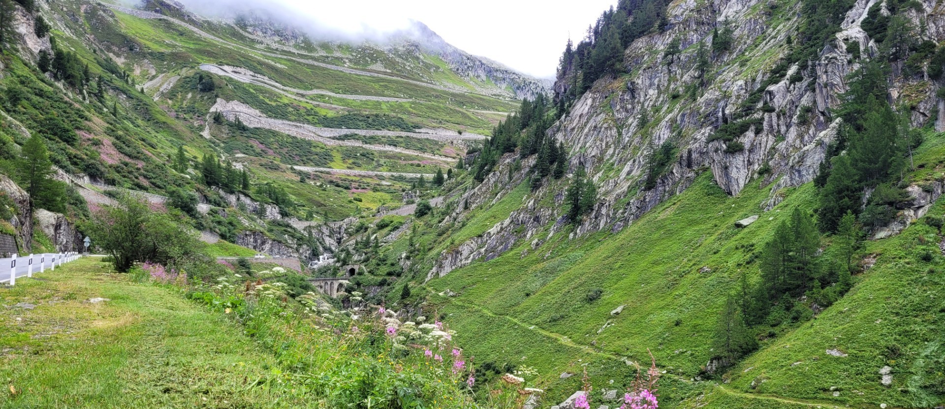
The 45-kilometer pass road was not completed until the 1940s. The actual summit is bypassed through a road tunnel. The western descent passes the Stein Glacier before reaching Innertkirchen.
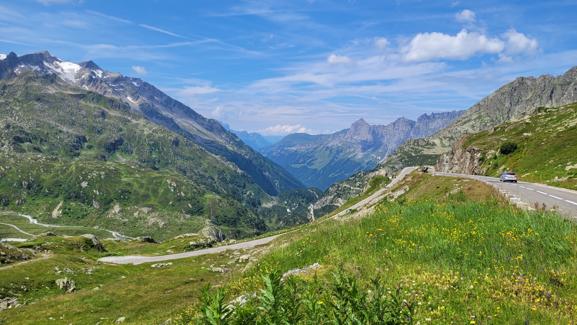
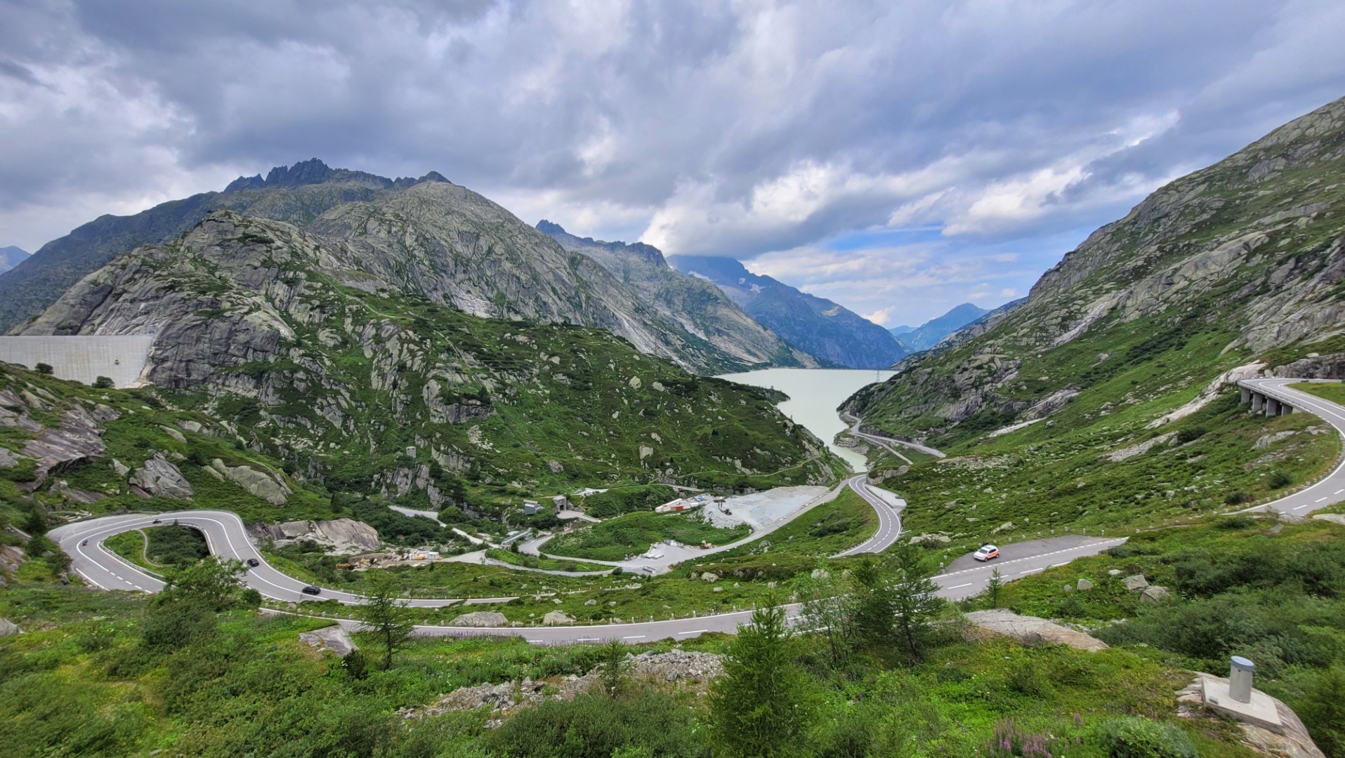
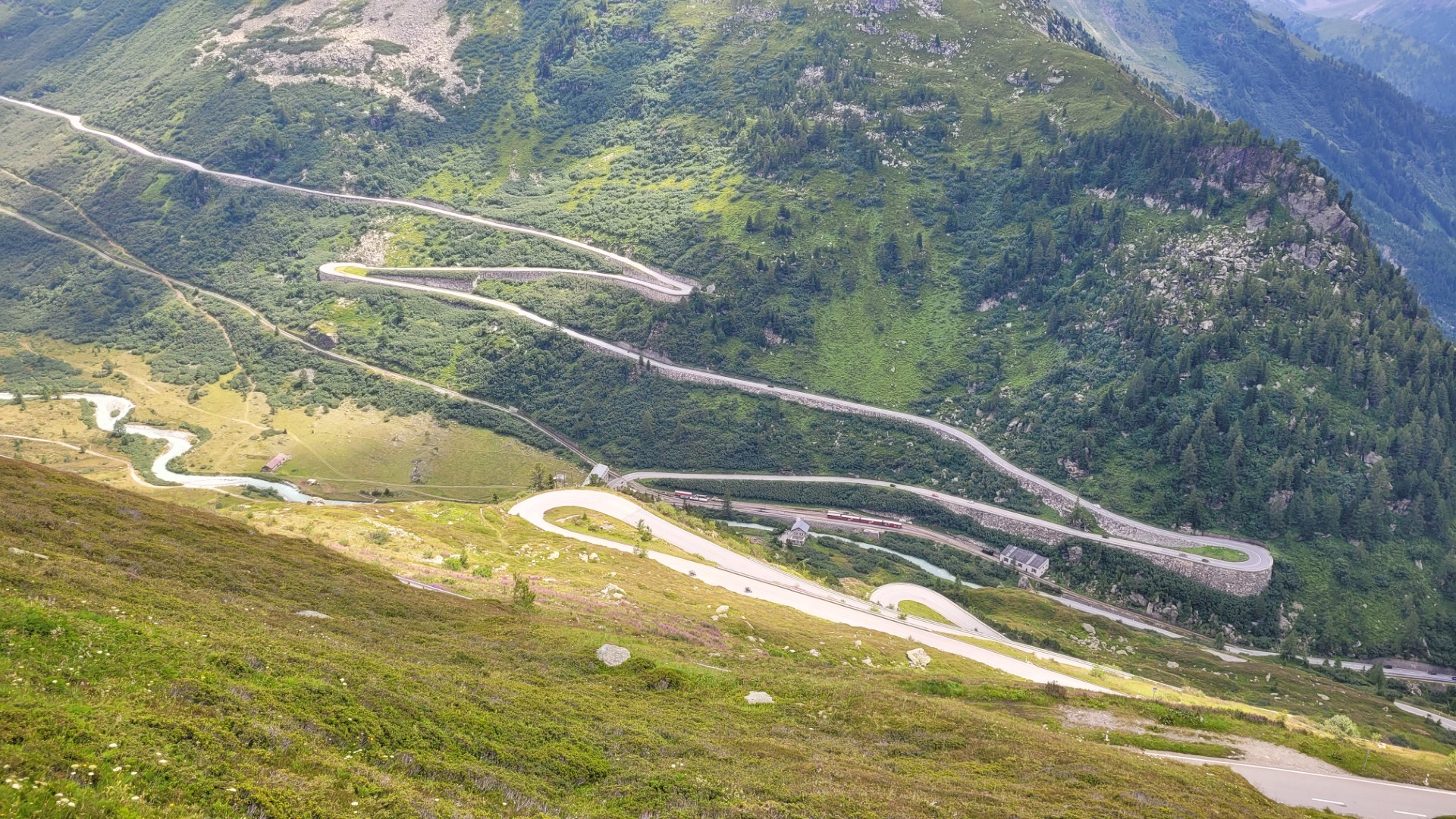
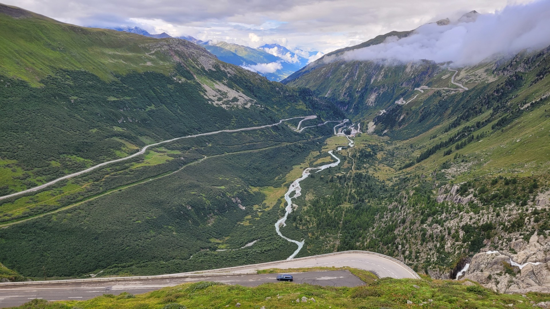
From there, we continue south to the next highlight. The Grimsel Pass (5) stretches for 46 well-developed kilometers and reaches an elevation of 2,165 meters, marking the European watershed between the North Sea and the Mediterranean. The southern descent is particularly spectacular, with steep and tightly packed hairpin bends carved into the mountainside.
To conclude the first stage, we cross the Simplon Pass (6) (2,006 m), which connects Switzerland and Italy. Although the pass features only a few hairpin bends, the southern descent through the narrow Gondo Gorge is well worth the ride.
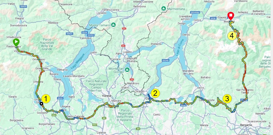
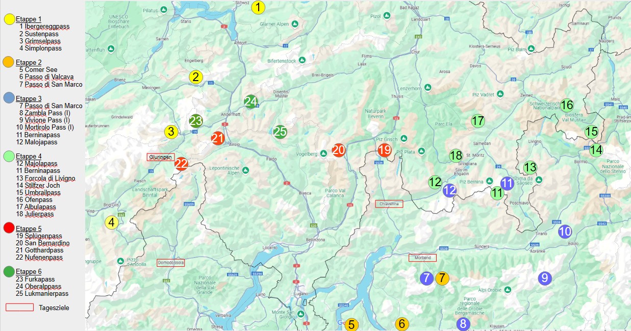
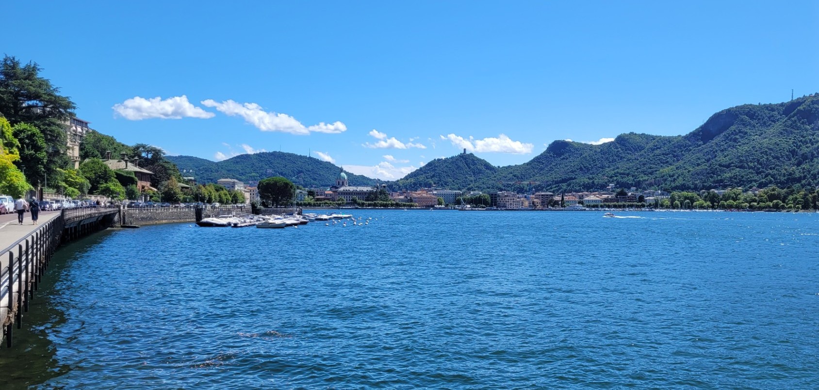
During the second stage, we ride along sections of the lakeside roads of Lake Orta (1), Lake Maggiore, Lake Como (2), and Lake Garlate before returning to the mountains. The first pass, Passo di Valcava (3), may only reach 1,336 meters, but it is a true mountain pass with steep, winding ascents full of enjoyable hairpins.
The highlight of the second stage is Passo San Marco (4). The 45-kilometer route is one continuous festival of curves set in breathtaking scenery.
We begin the third stage in Morbegno and head south, once again crossing Passo San Marco. In Antea, we turn east and continue to Colle di Zambla (2) (1,264 m), which is particularly enjoyable thanks to the curves and hairpins on its eastern descent toward Ponte Nossa.
Next comes Passo del Vivione (3), often described as “one of the most beautiful of Italy’s remote mountain passes.” The narrow and not always perfectly surfaced road impresses with its magnificent setting amid the vast gorges and alpine meadows of the Bergamasque Alps, as well as its occasionally demanding route layout.
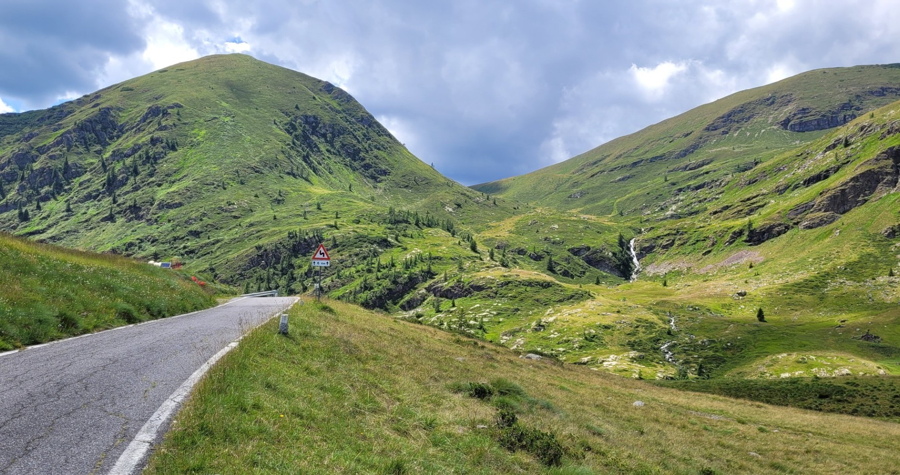
Beyond Edolo, the 1,852-meter-high Passo del Mortirolo (4) follows, another relatively unknown pass offering plenty of variety with its narrow but consistently twisty road. Much better known is the next pass of the day, the Bernina Pass (5). At 2,330 meters, this perfectly engineered pass, with views of glaciers and lakes, ranks among the most beautiful crossings in Switzerland.
The final pass before reaching the day’s destination of Chiavenna is the unusual Maloja Pass (6). Unusual because it effectively has only one ramp. Approaching from the northwest, riders travel through St. Moritz and the flat Engadine Valley to Maloja. From the village exit onward, the road drops nearly 1,100 meters over approximately 23 kilometers to the Italian border. The first few kilometers, in particular, are spectacularly carved into the steep mountainside.
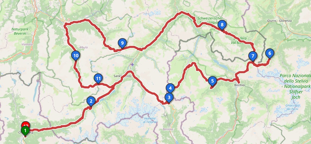
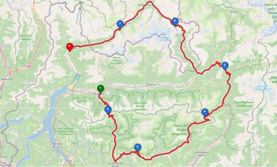
On the fourth day, a 370-kilometer loop from Chiavenna takes us across more than a dozen mountain passes, nine of them above 2,000 meters. We begin with the Maloja Pass (2) and the Bernina Pass (3), both ridden in the opposite direction the previous day. Shortly beyond the Bernina summit, we head north over the 2,315-meter Passo Forcola di Livigno (4) into Italy. Continuing toward Bormio, we cross the relatively unspectacular Passo d’Eira (2,208 m) and Passo di Foscagno (5) (2,291 m).
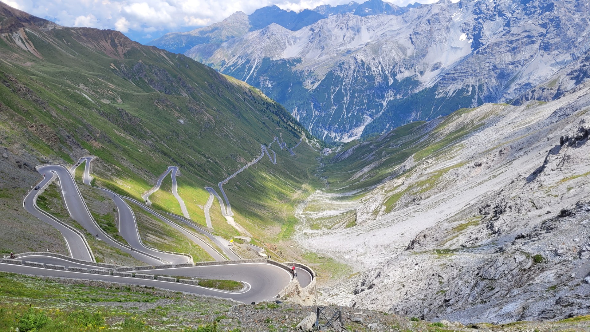
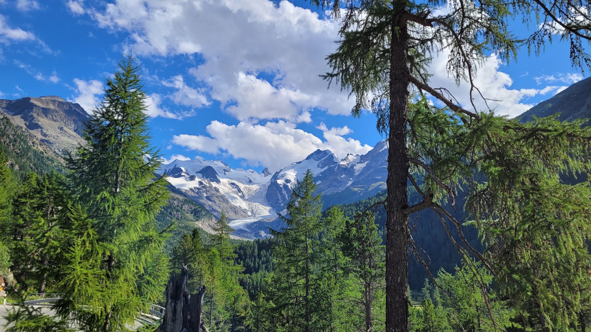
Things become much more dramatic beyond Bormio. Stelvio Pass (6), at 2,757 meters, is the highest mountain pass in Italy. Even the 36 hairpins on the 20 kilometers from Bormio to the summit are an experience. Truly unique, however, is the eastern flank, a panoramic road featuring 48 breathtaking hairpin bends.
We descend the eastern flank to Trafoi, turn around, and enjoy the climb back to the summit. After Italy’s highest road pass comes Switzerland’s highest road pass, the 2,503-meter Umbrail Pass (7). Thirty-three hairpins lead northward into Switzerland’s Val Müstair. Once in the valley, the road immediately climbs again to Ofen Pass (8), whose summit lies at 2,150 meters. From there, we descend to Zernez in the Engadine Valley and follow the valley for several kilometers before turning north toward Albula Pass (9). At 2,315 meters, this pass is exceptionally varied both in terms of scenery and road layout. The pass road crosses the route of the Rhaetian Railway several times with its impressive stone viaducts and descends through the narrow Albula Gorge to Tiefencastel.
From here, the route immediately climbs the 36-kilometer northern ramp of the 2,284-meter Julier Pass (10). The well-developed road overcomes an elevation gain of 1,433 meters. In just seven kilometers, we descend from the summit to Silvaplana. Once again, we cross the Maloja Pass before returning to our hotel in Chiavenna.
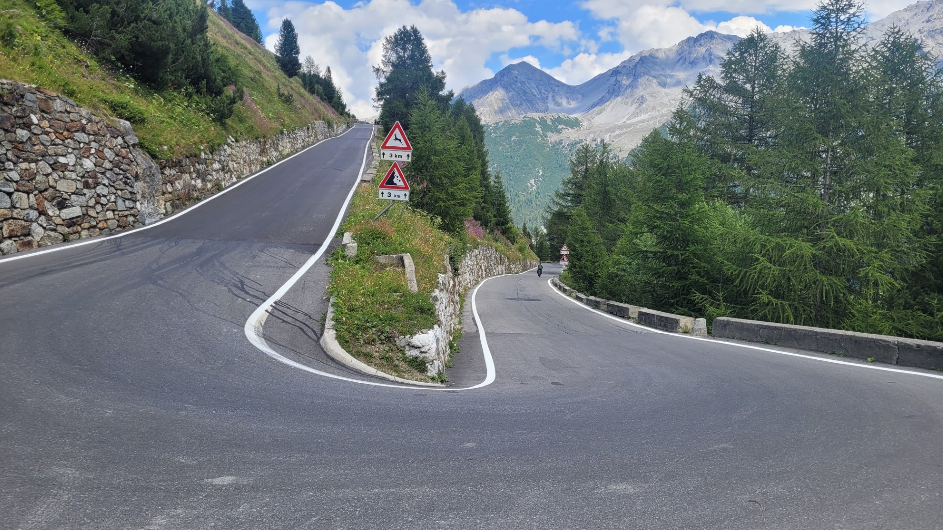
The fifth day originally calls for nearly 300 kilometers and six passes, but thunderstorms are forecast for the afternoon, requiring a more flexible route plan. The morning initially proceeds according to schedule. We leave Chiavenna heading north and cross the 2,118-meter Splügen Pass (1) into Switzerland. The 32-kilometer southern ramp contains 51 hairpins, and the northern side in Switzerland is equally rich in well-developed curves and switchbacks.
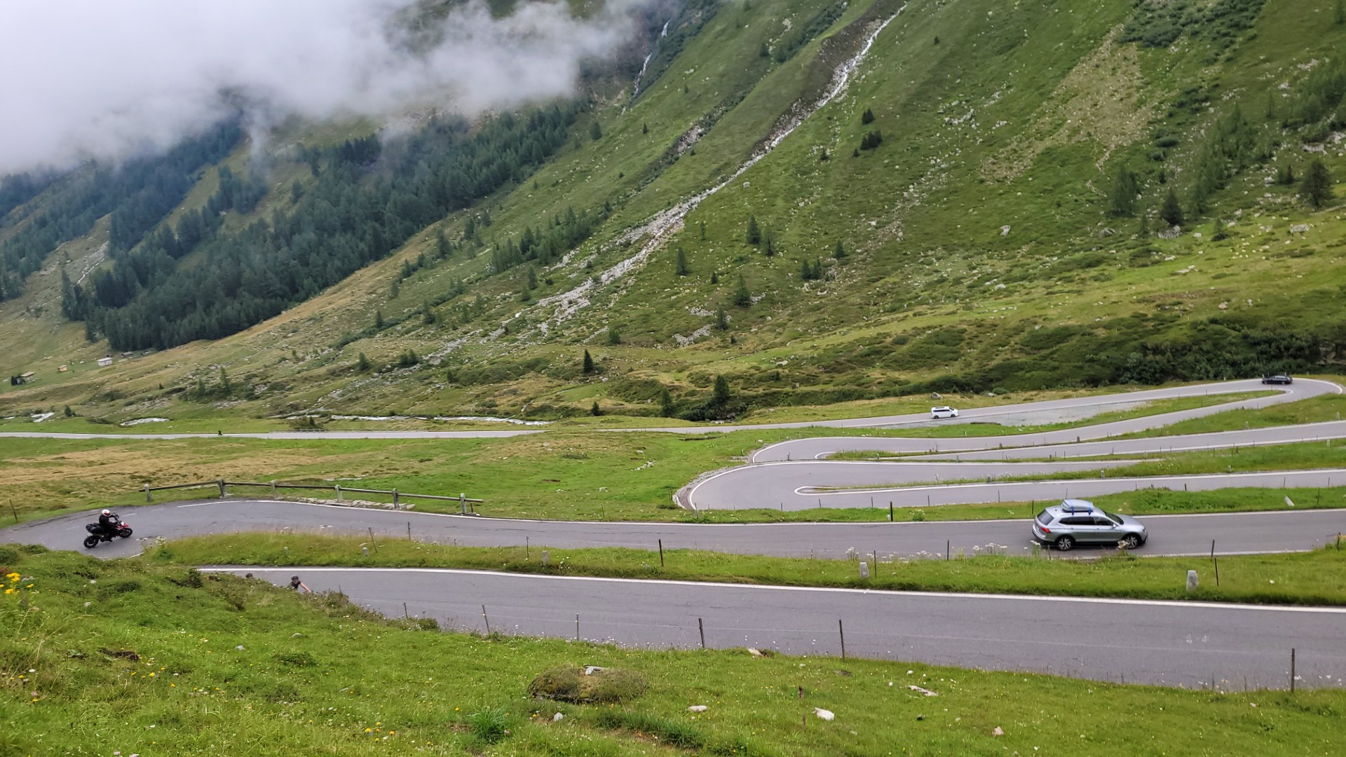
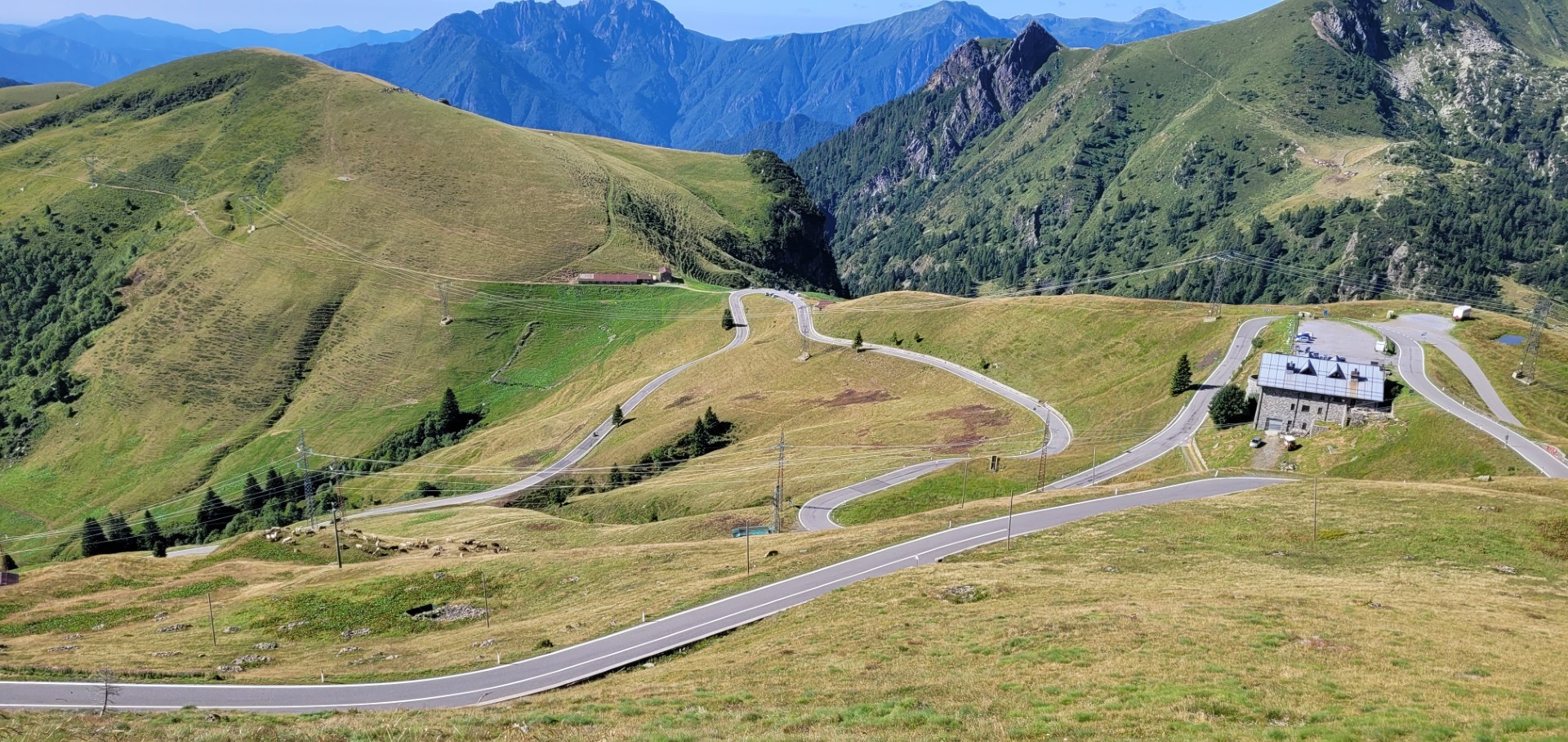
Next comes Passo di San Bernardino (2), one of my favorite Alpine passes thanks to its varied road profile and light traffic. Those in a hurry can take the motorway tunnel. We actually have plenty of time, but the clouds are thickening, prompting us to shorten the stage. Instead of crossing Lukmanier Pass and Oberalp Pass, we head directly to Gotthard Pass (3). After all, we are determined to ride the old Tremola road with its legendary cobblestone surface – and preferably in dry conditions.
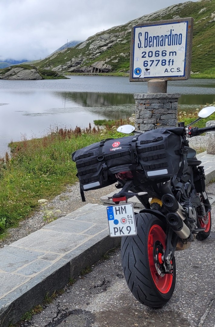
The sky is already quite dark when we turn onto the Tremola in Airolo. The first drops begin to fall, and shortly before the Kittelmann hairpin, rain and thunder become so intense that we turn around and seek shelter.
Eventually, the thunderstorm passes, but heavy rain continues. Unfortunately, the Tremola and Gotthard Pass are not meant to be this time. We put on our rain gear and ride from Airolo toward Nufenen Pass (4) in pouring rain. Remarkably, the rain finally stops, and shortly before reaching the 2,478-meter summit, the road even dries out. Nevertheless, we are glad that only about 20 kilometers remain to our hotel in the Rhône Valley.
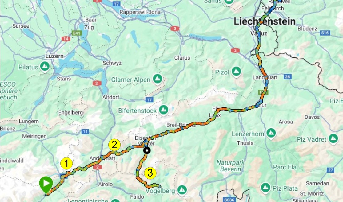
On the final day of the tour, conditions are dry but quite cold. The previous day’s storm has brought a significant change in the weather. When we reach the summit of Furka Pass (1), the thermometer reads just 8°C, and we find ourselves at 2,436 meters surrounded by clouds. Our final view back into the Rhône Valley came about 200 meters lower, near the former Hotel Belvedere overlooking the Rhône Glacier.
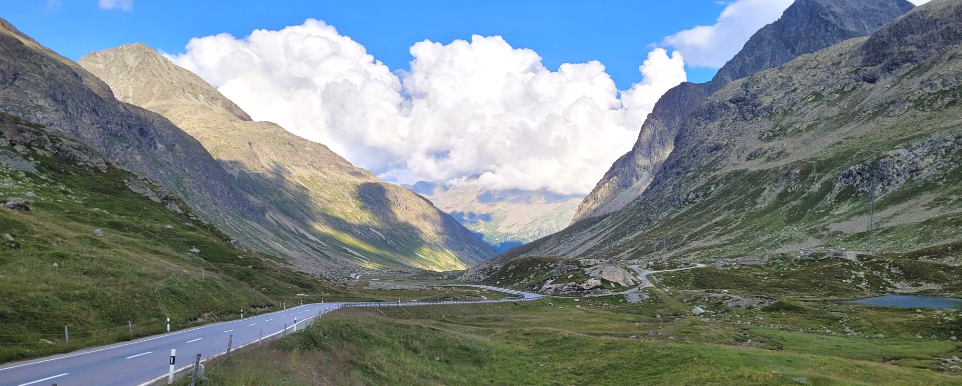
During the descent toward Andermatt, temperatures gradually climb back into double digits, and halfway down we emerge below the cloud layer. In Andermatt, it is at least 14°C, but we immediately climb again toward Oberalp Pass (2) and back into the clouds. Little of the high-alpine scenery is visible, but that does little to diminish the joy of riding. Instead of taking the direct route through the Rhine Valley toward Feldkirch, I decide on a detour via Lukmanier Pass (3). At 1,915 meters, it is not among the most famous Alpine passes, but it is lightly traveled and, above all, rewards riders with beautiful scenery.